OzGISMac 14.7-14.11.2020 freeware
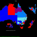
OzGISMac is an extensive system for the analysis and display of geographically referenced data. About 150 menus provide an enormous range of options The system can be used to analyze socio-economic and demographic data produced by censuses and surveys and to support management decisions associated with for example marketing, sales, site and personnel location, and advertising. Other spatial data such as environmental data can be displayed. ...
| Author | OzGIS |
| Released | 2020-11-14 |
| Filesize | 307 kB |
| Downloads | 468 |
| OS | Mac OS X, |
| Installation | Install Only |
| Keywords | mapping, census, territory, GIS |
| Users' rating (16 rating) |
OzGISMac Free Download - we do not host any OzGISMac torrent files or links of OzGISMac on rapidshare.com, depositfiles.com, megaupload.com etc. All OzGISMac download links are direct OzGISMac download from publisher site or their selected mirrors.
| 14.7-14.11.2 | Nov 14, 2020 | New Release | Improved Release |
| 14.7-14/11/2 | Nov 14, 2020 | New Release | Improved Release |
| 14.7-14.11.2 | Nov 14, 2020 | New Release | Improved Release |