- Freeware
- - Home & Hobby
- - Other
- - MyTourbook
MyTourbook 24.11.0 freeware
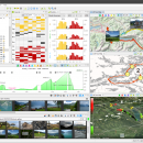
MyTourbook, developed by Wolfgang Schramm, is a powerful open-source software designed for outdoor enthusiasts and fitness aficionados. It enables users to analyze and visualize their tour data, offering comprehensive features like route planning, performance tracking, and detailed statistics. With support for various GPS devices and formats, MyTourbook caters to cyclists, hikers, and runners alike. Its intuitive interface and customizable options make it an essential tool for anyone looking to ... ...
| Author | Wolfgang Schramm |
| Released | 2024-10-30 |
| Filesize | 193.00 MB |
| Downloads | 1442 |
| OS | Windows 11, Windows 10 64 bit, Windows 8 64 bit, Windows 7 64 bit |
| Installation | Instal And Uninstall |
| Keywords | Analyze Tour, Tour, Map, Route, Analyze |
| Users' rating (19 rating) |
MyTourbook Free Download - we do not host any MyTourbook torrent files or links of MyTourbook on rapidshare.com, depositfiles.com, megaupload.com etc. All MyTourbook download links are direct MyTourbook download from publisher site or their selected mirrors.
| 24.11.0 | Oct 30, 2024 | New Release | New: Tour Book View: Create tour markers by distance or time #1319 Added column for tour description, the displayed text is truncated to 100 characters 2D Map: Support fair use for map providers with a tile image request limiter #1417 2.5D Map: Show high quality photo images #1419 Hint: Too many photo images can slowing down this map Tour Search: Push tours from the fulltext search result into the Tour Book view #1379 Tour Info Tooltip: Customize content #1411 Tour Tag Groups #1358: Define a group with tags Set all tags from a group within all tour views with easy import Tour Location: Set start/end location names which has no geo positions #1413 Changes: Tour Info Tooltip: The weather text is not wrapped anymore, it is now truncated but the text can be selected and scrolled to see the whole text Tour Type Preferences: Renamed preference page Swapped preference page Tag Preferences: Renamed preference page Bugfix: 4k Display: Fixed: It was difficult to hover movabel tooltips when the mouse was moved not fast enough See also milestone 24.11 https://github.com/mytourbook/mytourbook/milestone/19?closed=1 Translation: Dutch (Maarten) French (Frederic) German Italian (Doriano) System: MyTourbook Milestone 24.11 https://github.com/mytourbook/mytourbook/milestone/19?closed=1 Java 17 https://adoptium.net/temurin/releases/?version=17 Eclipse 2024-03 (4.31) https://download.eclipse.org/eclipse/downloads/drops4/R-4.31-202402290520/ NatTable 2.20 https://www.eclipse.org/nattable/download.php Nebula Widgets https://download.eclipse.org/nebula/releases/latest FIT SDK 21.141.0 https://forums.garmin.com/developer/fit-sdk/b/news-announcements WorldWind 2.2.1 https://github.com/NASAWorldWind/WorldWindJava/releases/tag/v2.2.1 |
| 24.9.0 | Sep 12, 2024 | New Release | New: Beautified 4k Displays: The main focus in this version was that MyTourbook looks better on 4k displays 1389 Rescaled 550+ icons 2D Map Support @2x map tile images Rescaled map legend Rescaled SRTM map color provider 2D Map: Waypoints are now painted as map points Improvements: Tour Type Icon: Customize image scaling Changes: 2D Map: Show waypoints action in the context menu is moved into the map points slideout Bugs: See milestone 24.9 Translation: Skipped, there are only a few new texts System: MyTourbook Milestone 24.8 Java 17 Eclipse 2023-06 (4.28) NatTable 2.20 Nebula Widgets latest FIT SDK 21.141.0 3D Map 2.2.1 |
| 24.8.0 | Aug 11, 2024 | New Release | New: 2D Map: Photo tooltip Photos are not overlapped Set photo rating which is used for photo filtering Improvements: 2D Map: Show tour marker link in it's tooltip Tour Chart: Paint photo point with better contrast color for the dark theme Bugs: See milestone 24.8 Translation: Dutch (Maarten) French (Frederic) German Italian (Doriano) |


