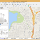
QGIS for Mac 3.36.1 freeware

QGIS supports vector, raster, and database formats and lets you browse and create map data on your computer.
QGIS supports many common spatial data formats (e.g. ESRI ShapeFile, geotiff). QGIS supports plugins to do things like display tracks from your GPS.
QGIS aims to be an easy to use GIS, providing common functions and features. The initial goal was to provide a GIS data viewer. ...

Author Gary Sherman
Released 2024-03-26
Filesize 1600.00 MB
Downloads 746
OS Mac OS X
Installation Instal And Uninstall
Keywords geographic information system, map creator, map viewer, GIS, geographic information, create, QGIS for Mac
Users' rating
(23 rating)
QGIS for MacCADMac OS X
QGIS for Mac - layer 2 Freeware Download Notice

QGIS for Mac Free Download - we do not host any QGIS for Mac torrent files or links of QGIS for Mac on rapidshare.com, depositfiles.com, megaupload.com etc. All QGIS for Mac download links are direct QGIS for Mac download from publisher site or their selected mirrors.

QGIS for Mac freeware - The Latest User Reviews
QGIS for Mac freeware - The Latest Versions History
3.36.1 Mar 26, 2024 New Release
3.36.2 Apr 25, 2024 New Release
3.36.1 Mar 26, 2024 New Release

Most popular CAD freeware downloads

Digimizer

6.4.0 freeware download

... Binarization Options: overlay binary image, hide binary layer Morphological operations: Dilate, Erode, Open, Close Noise reduction Analyze objects: object detection with measurement of perimeter ...

QGIS for Mac

3.36.1 freeware download

... analysis · On the fly projection of vector layers · Map composer · Identify features · Display ... applications · Improved MapServer export tool · Vector layer transparency and antialiasing · GRASS support in all ...

UCL Depthmap

0.8.0 freeware download

... and the measures may be transferred to gate layers in order to compare with indicators of pedestrian ... · OpenStreetMap, Tiger Line and Ordnance Survey ITN layer loaders · Text, SVG and EPS export ...

CARIS Easy View

4.2.13 freeware download

... of files. It allows you to load multiple layers, change their order and adjust object parameters. View ... in which they are drawn and adjust each layer's display parameters. Users can also make selections and ...

Thuban for Windows

1.2.2 freeware download

... features: # Vector Data Support: Shapefile, PostGIS Layer and OGR # Raster Data Support: GeoTIFF Layer and GDAL # Comfortable Map Navigation # Object ... Statusbar * Toolbar and * Menubar Layer Properties Aside the layer title the properties dialog ...

VisualCAM

1.0.5.0 freeware download

... in any of the viewports · Select by Layer, Color, Type & Name · Select by geometry types (Points, Lines/Polylines, Arcs/Circles, Polycurves, Dimensions, Surfaces) ...

GstarCAD MC

3.3.1 freeware download

... Scale, Color, Measure object, record management results, manage layers and use Layout. • Advanced drawing and editing ... and 3D Hidden with the powerful tools of Layer, Layout, and ten different perspectives viewing. • Rotate ...

ExPCB Helper

1.3 freeware download

... be on the Silk , Bottom or Top layer; Import a CSV file that has all the ... pixels will be drawn on the Silk Screen layer only. V 1.1 Supports DXF import. Layer 1 ...

ArcReader

10.5.0 B6491 freeware download

... be contained in these maps through the multiple layers supported by PMF documents can be viewed up ... Print published map and globe documents including all layer symbology and cartographic map elements on any supported ...

QGIS

3.36.1 freeware download

... analysis · On the fly projection of vector layers · Map composer · Identify features · Display ... applications · Improved MapServer export tool · Vector layer transparency and antialiasing · GRASS support in all ...