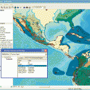
ArcReader 10.5.0 B6491 freeware

ArcReader is a free, easy-to-use desktop mapping application that allows users to view, explore, and print maps and globes. ArcReader is a free and easy-to-use application that allows users to view and print maps that are published as Published Map Files (PMF) by the ArcGIS Publisher extension to ArcView, ArcEditor, and ArcInfo. ...

Author ESRI
Released 2017-02-02
Filesize 444.00 MB
Downloads 540
OS Windows XP, Windows Vista, Windows Vista x64, Windows 7, Windows 7 x64, Windows 8, Windows 8 x64
Installation Instal And Uninstall
Keywords view map, print PMF map, export bitmap, view, viewer, map, print
Users' rating
(18 rating)
ArcReaderCADWindows XP, Windows Vista, Windows Vista x64, Windows 7, Windows 7 x64, Windows 8, Windows 8 x64
ArcReader - layer 2 Freeware Download Notice

ArcReader Free Download - we do not host any ArcReader torrent files or links of ArcReader on rapidshare.com, depositfiles.com, megaupload.com etc. All ArcReader download links are direct ArcReader download from publisher site or their selected mirrors.

ArcReader freeware - The Latest User Reviews
ArcReader freeware - The Latest Versions History
10.5.0 B6491 Feb 2, 2017 New Release
10.4 B5524 Apr 10, 2016 New Release
10.3 B4332 Jan 2, 2015 New Release

Most popular CAD freeware downloads

Digimizer

6.4.0 freeware download

... Binarization Options: overlay binary image, hide binary layer Morphological operations: Dilate, Erode, Open, Close Noise reduction Analyze objects: object detection with measurement of perimeter ...

ExPCB Helper

1.3 freeware download

... be on the Silk , Bottom or Top layer; Import a CSV file that has all the ... pixels will be drawn on the Silk Screen layer only. V 1.1 Supports DXF import. Layer 1 ...

QGIS for Linux

3.36.1 freeware download

... analysis · On the fly projection of vector layers · Map composer · Identify features · Display ... applications · Improved MapServer export tool · Vector layer transparency and antialiasing · GRASS support in all ...

Thuban for Windows

1.2.2 freeware download

... features: # Vector Data Support: Shapefile, PostGIS Layer and OGR # Raster Data Support: GeoTIFF Layer and GDAL # Comfortable Map Navigation # Object ... Statusbar * Toolbar and * Menubar Layer Properties Aside the layer title the properties dialog ...

Br3D

1.3 freeware download

... Button + Mouse Move Convenience Features Current color, layer, line type options Save As Save As Image ... Box, Cylinder, Cone, Torus, Sphere Terrain Create terrain(by layer, by entity, by grid), Up/Down terrain, Coloring terrain(gradation), ...

DipTrace Free

4.3.0.0 freeware download

... boards automatically with a full control over the layer stackup. Smart manual routing tools allow designing complex high-density boards with differential pairs and high-speed data ...

CARIS Easy View

4.2.13 freeware download

... of files. It allows you to load multiple layers, change their order and adjust object parameters. View ... in which they are drawn and adjust each layer's display parameters. Users can also make selections and ...

Elshayal Smart

23.02 freeware download

... jpg, bmp and Edit shape files, build new layer, add existing layer, remove layers, swap layers, save layer, set layer data source, layer properties, zoom in ...

QGIS

3.36.1 freeware download

... analysis · On the fly projection of vector layers · Map composer · Identify features · Display ... applications · Improved MapServer export tool · Vector layer transparency and antialiasing · GRASS support in all ...

QGIS for Mac

3.36.1 freeware download

... analysis · On the fly projection of vector layers · Map composer · Identify features · Display ... applications · Improved MapServer export tool · Vector layer transparency and antialiasing · GRASS support in all ...