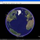
Google Earth for Mac OS X 7.3.6.10155 freeware
Google Earth Pro is a powerful desktop application that transforms the way users explore the planet. With stunning 3D imagery, detailed satellite maps, and a wealth of geographic data, it allows users to virtually travel anywhere on Earth. The software features advanced tools for measuring distances, creating custom maps, and even visualizing historical imagery. Ideal for educators, researchers, and curious minds alike, Google Earth Pro combines accessibility with depth, making global exploratio ... ...
| Author | |
| Released | 2024-12-16 |
| Filesize | 1.30 MB |
| Downloads | 788 |
| OS | Windows 11, Windows 10 32/64 bit, Windows 8 32/64 bit, Windows 7 32/64 bit |
| Installation | Instal And Uninstall |
| Keywords | map measurement, geographic data, map, Google Earth Pro free download, explore, 3D visualization, globe, desktop application, Google Earth Pro, mapping, Earth, analyze map |
| Users' rating (33 rating) |
Google Earth for Mac OS X Free Download - we do not host any Google Earth for Mac OS X torrent files or links of Google Earth for Mac OS X on rapidshare.com, depositfiles.com, megaupload.com etc. All Google Earth for Mac OS X download links are direct Google Earth for Mac OS X download from publisher site or their selected mirrors.
| 7.3.6.10155 | Dec 16, 2024 | New Release | Movie Maker tool: Hardware-accelerated video encoding for faster processing and better image quality. HEVC (H.265) codec support. Full navigation controls, including Historical Imagery and Street View, available in live recording mode. Better responsiveness during live recording. Can defer video encoding until after live recording is finished. In live recording mode, less obtrusive recording status dialog. Live recordings accurately show the timing of user actions during the recording session. Save video frames in QOI image format. Break apart a Multi Geometry place mark into individual place marks. Combine multiple selected place marks into a single Multi Geometry place mark. Import GeoJSON files. Improved printing tool quality. Save Image tool: Increased maximum image size. PNG format support. Adjusted Google Earth logo size in main view, saved images, and printouts. Automatically support high-DPI displays. Regionate tool supports KML Schema extended data. Consistently save KML files with no changes from session to session. Correctly import CSV files with values that contain quotation marks. Edit KML LinearRing place mark line style. Other minor fixes and improvements. |
| 7.3.6.9750 | Jan 18, 2024 | New Release | |
| 7.3.6.9345 | Jan 4, 2023 | New Release |


