- Freeware
- - Graphic Apps
- - CAD
- - LanDTM
LanDTM 6.1 freeware
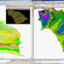
There is not any professional program on internet like this and you can get it without any effort. I think this could be a handicap because it's dificult to believe, but it's true; try it and you'll be surprised. It's not only a program to calculate a delaunay triangulation but you can input break-lines to get a real representation of the terrain.
| Author | Aplicaciones Topográficas S.L. |
| Released | 2017-04-23 |
| Filesize | 58.80 MB |
| Downloads | 614 |
| OS | Windows XP, Windows Vista, Windows Vista x64, Windows 7, Windows 7 x64, Windows 8, Windows 8 x64, Windows 10, Windows 10 x64 |
| Installation | Instal And Uninstall |
| Keywords | Delaunay triangulation, Terrain Representation, CAD addon, Delaunay triangulation, Calculate, Terrain |
| Users' rating (10 rating) |
LanDTM Free Download - we do not host any LanDTM torrent files or links of LanDTM on rapidshare.com, depositfiles.com, megaupload.com etc. All LanDTM download links are direct LanDTM download from publisher site or their selected mirrors.
| 6.1 | Apr 23, 2017 | New Release | |
| 6.1.6 | Feb 16, 2012 | New Release | · New installers of the program to 32 and 64 bits platforms. · LanDTM on BricsCAD v12. · LanDTM on Autocad 2012. · Separator/discriminator of points. · Compatibility with "gsf" grid files REDNAP of Geoid ondulation. · Elevation modification of PPuntos. · Importation/exportationn of Points to PPuntos. · Compatibility between formats. Trimble M3, GPS Trimble, GSI of Stonex. |
| 6.1.5 | Oct 5, 2011 | New Release | · You can digitalize lines and points in Google Earth and export them to the CAD. It Works in BricsCAD v11. |


