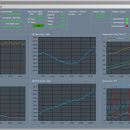
Weather Station Data Logger 5.6.0.0 freeware
This Windows application will display and log weather data obtained through a USB connection to the Oregon Scientific WMR88, WMR100, WMR200 and RMS300 weather stations. You will find features here for a wide range of users, from novices, to experts. The extensive user manual describes program features in detail and includes informative discussions on many topics. ...
| Author | Sourceforge |
| Released | 2019-10-02 |
| Filesize | 3.50 MB |
| Downloads | 678 |
| OS | Windows XP, Windows Vista, Windows Vista x64, Windows 7, Windows 7 x64, Windows 8, Windows 8 x64, Windows 10, Windows 10 x64 |
| Installation | Instal And Uninstall |
| Keywords | weather data, data logger, log data, weather, analyze, analyzer, Weather Station Data Logger |
| Users' rating (30 rating) |
Weather Station Data Logger Free Download - we do not host any Weather Station Data Logger torrent files or links of Weather Station Data Logger on rapidshare.com, depositfiles.com, megaupload.com etc. All Weather Station Data Logger download links are direct Weather Station Data Logger download from publisher site or their selected mirrors.
| 5.6.0.0 | Oct 2, 2019 | New Release | The current beta release (5.4.2.0) supports four new sensors for WxShield users: OS BTHGN129, AcuRite 00592TXR tower and Ambient Weather WH2C and F007TH units. A WxShield sketch update is required to add these capabilities. For the time being this release only supports PC Connect Mode 4 on the 02032C console. Eventually we hope to add support for PC Connect Mode 3 and other AcuRite consoles as well. |
| 5.3.6.1 | Aug 25, 2015 | New Release | The current beta release (5.4.2.0) supports four new sensors for WxShield users: OS BTHGN129, AcuRite 00592TXR tower and Ambient Weather WH2C and F007TH units. A WxShield sketch update is required to add these capabilities. For the time being this release only supports PC Connect Mode 4 on the 02032C console. Eventually we hope to add support for PC Connect Mode 3 and other AcuRite consoles as well. |
| 4.5.6.1 | May 10, 2015 | New Release | The current beta release (5.4.2.0) supports four new sensors for WxShield users: OS BTHGN129, AcuRite 00592TXR tower and Ambient Weather WH2C and F007TH units. A WxShield sketch update is required to add these capabilities. For the time being this release only supports PC Connect Mode 4 on the 02032C console. Eventually we hope to add support for PC Connect Mode 3 and other AcuRite consoles as well. |


