ATCalc 4.0 freeware

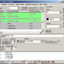
Write the calculations you wish to make on one line: you can thus see and write, for example (12*3)/(4+2+8) and ATCalc is was specially developed as complex graphic calculator that features a programming environment. you can review if they have been correctly typed. ...

Author Jordi March Nogue
Released 2011-12-05
Filesize 2.70 MB
Downloads 342
OS Windows XP, Windows Vista, Windows Vista x64, Windows 7, Windows 7 x64
Installation Instal And Uninstall
Keywords complex graphic calculator, review calculations, programming environment calculator, calculator, calculate, formula
Users' rating
(19 rating)
ATCalcCADWindows XP, Windows Vista, Windows Vista x64, Windows 7, Windows 7 x64
ATCalc - visualize Freeware Download Notice

ATCalc Free Download - we do not host any ATCalc torrent files or links of ATCalc on rapidshare.com, depositfiles.com, megaupload.com etc. All ATCalc download links are direct ATCalc download from publisher site or their selected mirrors.

ATCalc freeware - The Latest User Reviews
ATCalc freeware - The Latest Versions History
4.0 Dec 5, 2011 New Release The objects (TStringList, TRealList, TPointList and TRMatrix) now have their own functions and procedures, and many of those functions and procedures called objects, are now integrated in the object:
so if SL is a TStringList type, before there was to add a string the procedure SLAdd, and was:
SLAdd (SL, 'A string')now no longer exists SLAdd, and instead there is the procedure Add integrated in the TStringList, thus the result is:
SL.Add ('A string')but there is a procedure with the same name to add numbers to a TRealList, so for an object RL, like this:
RL.Add (12)obviously:
· RL.Add ('A string')produce an error message.
Renaming list:
For lists:
· LClear -> Clear
· LCount -> Count
· SLAdd / RLAdd / PLAddP -> Add
· SLAddStrings / RLAddNums / PLAddPoints -> AddItems
· SLIndexOf / RLIndexOf -> IndexOf
· SLGetItem / RLGetItem / PLGetItem -> GetItem
SLSetItem / RLSetItem -> SetItemFor lists and TRMatrix:
· LLoadedFFile / RMLoadedFFile -> LoadedFFile
· LSavedToFile / RMSavedToFile -> Saved

Most popular CAD freeware downloads

TNTatlas for Mac OS X

2024 B20240508 freeware download

TNTatlas is a powerful free geodata viewer that lets you publish and distribute your maps and geospatial data — from a single geodata file to complex ...

Ascalaph Graphics

1.7.12 freeware download

... cameras, which allow the model to be simultaneously visualized from two sides and in different graphic modes. The subwindow can be opened by dragging the ...

Cytoscape x64

3.10.0 freeware download

... Perform advanced analysis and modeling using Cytoscape plugins Visualize and analyze human-curated pathway datasets such as Reactome or KEGG. ...

RADlab

1.03 freeware download

... handling, Multi Channel Analyzer (MCA) and Oscilloscope to visualize the signals. ...

Gwyddion

2.66 freeware download

Gwyddion is a modular program for SPM (scanning probe microscopy) data visualization and analysis. Primarily it is intended for analysis of height fields obtained by scanning ...

Gwyddion for Linux

2.66 freeware download

Gwyddion is a modular program for SPM (scanning probe microscopy) data visualization and analysis. Primarily it is intended for analysis of height fields obtained by scanning ...

Thuban for Windows

1.2.2 freeware download

... data viewer (GIS viewer) which features methods to visualize, explore, and analyze geographic information. Thuban is an Interactive Geographic Data Viewer with the following ...

Gnuplot for Windows

5.2.7 freeware download

... originally created to allow scientists and students to visualize mathematical functions and data interactively, but has grown to support many non-interactive uses such as web ...

GProX

1.1.16 freeware download

... graphics in the incorporated Graphical display window Visualize of data distributions as: · Heatmaps · Scatter plots · Histograms · Box plots ...

TNTatlas

2024 B20240606 freeware download

TNTatlas is a powerful free geodata viewer that lets you publish and distribute your maps and geospatial data — from a single geodata file to complex ...