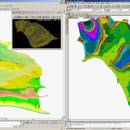
LanDTM 6.1 freeware

There is not any professional program on internet like this and you can get it without any effort. I think this could be a handicap because it's dificult to believe, but it's true; try it and you'll be surprised. It's not only a program to calculate a delaunay triangulation but you can input break-lines to get a real representation of the terrain. ...

Author Aplicaciones Topográficas S.L.
Released 2017-04-23
Filesize 58.80 MB
Downloads 588
OS Windows XP, Windows Vista, Windows Vista x64, Windows 7, Windows 7 x64, Windows 8, Windows 8 x64, Windows 10, Windows 10 x64
Installation Instal And Uninstall
Keywords Delaunay triangulation, Terrain Representation, CAD addon, Delaunay triangulation, Calculate, Terrain
Users' rating
(7 rating)
LanDTMCADWindows XP, Windows Vista, Windows Vista x64, Windows 7, Windows 7 x64, Windows 8, Windows 8 x64, Windows 10, Windows 10 x64
LanDTM - viewing t free t free Freeware Download Notice

LanDTM Free Download - we do not host any LanDTM torrent files or links of LanDTM on rapidshare.com, depositfiles.com, megaupload.com etc. All LanDTM download links are direct LanDTM download from publisher site or their selected mirrors.

LanDTM freeware - The Latest User Reviews
LanDTM freeware - The Latest Versions History
6.1 Apr 23, 2017 New Release
6.1.6 Feb 16, 2012 New Release · New installers of the program to 32 and 64 bits platforms.
· LanDTM on BricsCAD v12.
· LanDTM on Autocad 2012.
· Separator/discriminator of points.
· Compatibility with "gsf" grid files REDNAP of Geoid ondulation.
· Elevation modification of PPuntos.
· Importation/exportationn of Points to PPuntos.
· Compatibility between formats. Trimble M3, GPS Trimble, GSI of Stonex.
6.1.5 Oct 5, 2011 New Release · You can digitalize lines and points in Google Earth and export them to the CAD. It Works in BricsCAD v11.

Most popular CAD freeware downloads

Xtreme Calculations

32.0 freeware download

Xtreme Calculations is a free calculator software which has been developed to provide ... Calculation Speed Index (CSI) Calculator, a utility for viewing images, an e-mail tool and two games, one ...

QFitsView

8.6 freeware download

... suite of visualization tools. Users can customize their viewing experience with a variety of scaling options, color maps, and region definitions, enabling precise control over ...

QGIS for Mac

3.36.1 freeware download

... on top of and proud to be itself Free and Open Source Software (FOSS). QGIS supports ... used by many for their daily GIS data viewing needs. QGIS supports a number of raster and ...

VariCAD Viewer for Linux

2024 2.01 freeware download

VariCAD Viewer is a free viewer, convertor and printing software working with 2D DWG, DXF, 3D STEP and 2D/3D VariCAD file formats. VariCAD viewer allows ...

ZWCAD Viewer

2017 freeware download

Free ZWCAD Viewer for CAD DWG File Viewing and Plotting Light and Easy-to-use No Matter the ... can enjoy a pleasant and easy .dwg file viewing experience. ZWCAD Viewer runs on different operating systems ...

ShareCAD

2.0 freeware download

ShareCAD is a free online service developed by CADSoftTools. With its help ... device connected to the Internet; - add drawing viewing to your website via free iFrame Plugin; - ...

LanDTM

6.1 freeware download

... to edit dynamically the drawn triangulation in autocad viewing the modifications as in the program as in ... or educational center you have the program fully free, but too, it's possible get it free collaborating ...

MyCadbox

1.0.0.0 freeware download

... iPad from email attachments and from Dropbox * Free iPad app available through Apple MyCadbox is an online CAD viewer enabling ultra-fast viewing, sharing, markup, and co-viewing of large 3D STEP ...

MeshMagic 3D Modeling Software Free

2.00 freeware download

With MeshMagic 3D, viewing and editing stl files has never been easier. ... MeshMagic is an excellent 3D modeling program for viewing and editing STL files. The interface is intuitive ...

QGIS

3.36.1 freeware download

... on top of and proud to be itself Free and Open Source Software (FOSS). QGIS supports ... used by many for their daily GIS data viewing needs. QGIS supports a number of raster and ...