Panoply for Mac 5.4.3 freeware

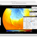
Panoply for Mac is an utility that enable user to plot raster image. Depending on the data, it can draw global longitude-latitude images or pole-to-pole latitude-vertical images.Panoply is a cross-platform application which plots geo-gridded arrays from netCDF, HDF and GRIB datasets. The utility can also combine two arrays and can project the analysis using more than 100 maps. ...

Author Robert B. Schmunk
Released 2024-06-24
Filesize 36.40 MB
Downloads 867
OS Mac OS X
Installation Instal And Uninstall
Keywords plot raster image, longitude image, pole-to-pole image, raster image, rasterize, raster
Users' rating
(38 rating)
Panoply for MacCADMac OS X
Panoply for Mac - view time Freeware Download Notice

Panoply for Mac Free Download - we do not host any Panoply for Mac torrent files or links of Panoply for Mac on rapidshare.com, depositfiles.com, megaupload.com etc. All Panoply for Mac download links are direct Panoply for Mac download from publisher site or their selected mirrors.

Panoply for Mac freeware - The Latest User Reviews
Panoply for Mac freeware - The Latest Versions History
5.4.3 Jun 24, 2024 New Release
5.4.1 Jun 1, 2024 New Release
5.4.0 May 11, 2024 New Release

Most popular CAD freeware downloads

FilterPro Desktop

3.1.0.23446 freeware download

... as ability to adjust passive element tolerances and view response variations; scale passive component values; and view and export filter performance data to Excel. ... from the functionality of v3.1. Easily generate schematics, view frequency and time responses, and print professional design ...

Panoply for Mac

5.4.3 freeware download

... GRIB datasets. Panoply is designed to help you view and process the data included in netCDF, HDF, ... color contour plots of geo-referenced latitude-longitude, latitude-vertical, longitude-vertical, time-latitude or time-vertical arrays sliced from 2D or larger ...

TNTatlas for Mac OS X

2024 B20240508 freeware download

TNTatlas is a powerful free geodata viewer that lets you publish and distribute your maps ... disaster relief, health and plant protection, or other time-critical management activities. TNTatlas, from MicroImages, Inc. is ...

Gephi for Mac OS X

0.10.1 freeware download

... as social networks can be filtered with the timeline component. · Import temporal graph with the GEXF ... Save/Load project files · Use the Data Table view to browse and edit data Modular: · ...

TNTatlas

2024 B20240606 freeware download

TNTatlas is a powerful free geodata viewer that lets you publish and distribute your maps ... disaster relief, health and plant protection, or other time-critical management activities. TNTatlas, from MicroImages, Inc. is ...

Gephi for Linux

0.10.1 freeware download

... as social networks can be filtered with the timeline component. · Import temporal graph with the GEXF ... Save/Load project files · Use the Data Table view to browse and edit data Modular: · ...

p3d

2.6.2 freeware download

... write a user-friendly tool that will reduce the time spent performing repetitive tasks in IFS data-reduction. p3d ... extracted images using the same or different exposure times, where all exposures target the same region. Examine ...

Ascalaph Graphics

1.7.12 freeware download

... multiple windows · Molecular model building · Multiple time step integration · Calculations on clusters with aid of MDynaMix · Flexible SPC water model ...

Integrated Genome Browser

7.0.4 B15225 freeware download

... then, community developers have continued to contribute their time and efforts to improving the software. In 2008, funding from National Science Foundation has allowed us ...

Kst

2.0.8 freeware download

Kst is the fastest real-time large-dataset viewing and plotting tool available (you may be interested in some benchmarks) and has built-in data analysis functionality. Kst ...