Panoply for Mac 5.4.3 freeware

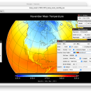
Panoply for Mac is an utility that enable user to plot raster image. Depending on the data, it can draw global longitude-latitude images or pole-to-pole latitude-vertical images.Panoply is a cross-platform application which plots geo-gridded arrays from netCDF, HDF and GRIB datasets. The utility can also combine two arrays and can project the analysis using more than 100 maps. ...

Author Robert B. Schmunk
Released 2024-06-24
Filesize 36.40 MB
Downloads 774
OS Mac OS X
Installation Instal And Uninstall
Keywords plot raster image, longitude image, pole-to-pole image, raster image, rasterize, raster
Users' rating
(29 rating)
Panoply for MacCADMac OS X
Panoply for Mac - view mac Freeware Download Notice

Panoply for Mac Free Download - we do not host any Panoply for Mac torrent files or links of Panoply for Mac on rapidshare.com, depositfiles.com, megaupload.com etc. All Panoply for Mac download links are direct Panoply for Mac download from publisher site or their selected mirrors.

Panoply for Mac freeware - The Latest User Reviews
Panoply for Mac freeware - The Latest Versions History
5.4.3 Jun 24, 2024 New Release
5.4.1 Jun 1, 2024 New Release
5.4.0 May 11, 2024 New Release

Most popular CAD freeware downloads

Panoply for Mac

5.4.3 freeware download

Panoply for Mac is a cross-platform application which plots geo-gridded arrays ... GRIB datasets. Panoply is designed to help you view and process the data included in netCDF, HDF, ...

TNTatlas for Mac OS X

2024 B20240508 freeware download

TNTatlas is a powerful free geodata viewer that lets you publish and distribute your maps ... nearby pages or turned to the index. To view related demographic, climatologic, or economic statistics, you looked ...

TNTmips for Mac OS X

20240111 freeware download

TNTmips for Mac is a complete Geographic Information System (GIS) that ... It provides all the tools you need to view, create, edit, georeference, interpret, and publish any type ...

ZWCAD Viewer

2017 freeware download

Free ZWCAD Viewer for CAD DWG File Viewing and Plotting Light and Easy-to-use No Matter the ... package compared to other demanding software, but ZWCAD Viewer is even much lighter as it does not ...

QGIS for Mac

3.36.1 freeware download

... initial goal was to provide a GIS data viewer. QGIS has reached that point in its evolution ... used by many for their daily GIS data viewing needs. QGIS supports a number of raster and ...

KiCad for Mac OS X

8.0.2 freeware download

... KiCad allows you to upload NET files and view the selected footprint, record macros, assign hotkeys, and ... instantly inspect your design in an interactive 3D view. Rotate and pan around to inspect details easier ...

TinyQuant

1.55 freeware download

... gel bands in 16 bit greyscale (PC or Mac format ".gel" or TIFF files) or 24 bit RGB TIFF images, and for converting these to ...

Gephi for Mac OS X

0.10.1 freeware download

... Save/Load project files · Use the Data Table view to browse and edit data Modular: · Gephi 0.7 architecture is modular and therefore allows ...

ADMB for Mac OS X

11.5 freeware download

... This is the place to come to view Frequently Asked Questions download ADMB for your compiler and OS view and download documentation view ADMB function reference guide ...

Kst for Mac OS X

2.0.7 freeware download

Kst is the fastest real-time large-dataset viewing and plotting tool available (you may be interested in some benchmarks) and has built-in data analysis functionality. Kst ...