ZWCAD Viewer 2017 freeware

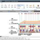
Free ZWCAD Viewer for CAD DWG File Viewing and Plotting. ZWCAD Viewer runs on different operating systems such as Windows ... & 64-bit), Mac OS and Linux. With ZWCAD Viewer, drawings can be viewed in all kinds of frequently used file formats like dwg, dwf, dwfx, dxf and dwt. ZWCAD Viewer is able to measure distance between objects, area ... closed shape, mass and volume of a 3D model, regions or coordinates on the drawings. ...

Author ZWCAD Design Co., Ltd
Released 2016-03-28
Filesize 161.95 MB
Downloads 327
OS Win2000, Windows XP, Windows 7 x32, Windows 7 x64, Windows 8, Windows 10, WinServer, WinOther, Windows Vista, Windows Vista x64
Installation Install and Uninstall
Keywords ZWCAD, DWG CAD, DWG Viewer, AutoCAD free download, free download CAD, AutoCAD, PDF print, PDF plotting
Users' rating
(18 rating)
ZWCAD ViewerCADWin2000, Windows XP, Windows 7 x32, Windows 7 x64, Windows 8, Windows 10, WinServer, WinOther, Windows Vista, Windows Vista x64
ZWCAD Viewer - view 3d model Freeware Download Notice

ZWCAD Viewer Free Download - we do not host any ZWCAD Viewer torrent files or links of ZWCAD Viewer on rapidshare.com, depositfiles.com, megaupload.com etc. All ZWCAD Viewer download links are direct ZWCAD Viewer download from publisher site or their selected mirrors.

ZWCAD Viewer freeware - The Latest User Reviews
ZWCAD Viewer freeware - The Latest Versions History
2017 Mar 28, 2016 New Release Open DWG, DXF, DWF and DWT file formats from version R12 to 2013
Smaller and quicker And it is the interface you are familiar with
Still be free for all following versions
View both 2D objects and 3D models
Zoom and pan, 3D Orbit helps you view with ease
View 3D models in hide mode
View proxy

Most popular CAD freeware downloads

TNTmips

20240404 freeware download

... It provides all the tools you need to view, create, edit, georeference, interpret, and publish any type ... Fitting, Contouring, and Triangulation operations produce Digital Elevation Model rasters (DEMs), contour lines, and triangulated irregular networks ...

Br3D

1.3 freeware download

Light weight, fast free 3D ViewerLight weight, fast free 3D Viewer Supports various 3D file format. Read : DWG, ... STP, STL, IGES, IGS, PRC, XML Mouse control View Rotation : Control Key + Mouse Wheel Button ...

CARIS Easy View

4.2.13 freeware download

CARIS Easy View is a simple application that enables you to view spatial data imported from numerous types of files. ... layers, change their order and adjust object parameters. View your spatial data using the free CARIS viewer. ...

OpenRocket

14.06 freeware download

OpenRocket is an free, fully featured model rocket simulator that allows you to design and ... OpenRocket features a full six-degree-of-freedom simulation, realistic wind modeling, a multitude of different components including free-form fins ...

X-Sweet Home 3D

4.4 [rev18] freeware download

... ยท While designing the home in 2D, simultaneously view it in 3D from an aerial point of view, or navigate into it from a virtual visitor ...

FieldVIZ

r165 freeware download

FieldVIZ is meant to allow easy visual inspection of electro- and magnetostatic fields in 2D and 3D. ...

VEGA ZZ

3.2.3.28 freeware download

VEGA ZZ is a complete molecular modelling suite that includes several features to make your ... hardware anti-aliasing, material management, 3D backgrounds. Stereo view (shutter or anaglyphic glasses). 10 bit output ...

NetLogo

6.0.4 freeware download

NetLogo is a multi-agent programmable modeling environment. It is used by tens of thousands ... can run simulations for various phenomena, providing 3D modeling tools and multiple visualization options. Generated models can ...

ZWCAD Viewer

2017 freeware download

Free ZWCAD Viewer for CAD DWG File Viewing and Plotting Light and Easy-to-use No Matter the ... package compared to other demanding software, but ZWCAD Viewer is even much lighter as it does not ...

TNTmips for Mac OS X

20240111 freeware download

... It provides all the tools you need to view, create, edit, georeference, interpret, and publish any type ... Fitting, Contouring, and Triangulation operations produce Digital Elevation Model rasters (DEMs), contour lines, and triangulated irregular networks ...