uDig for Mac OS X 1.4.0 freeware
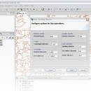
uDig is a user-friendly desktop Internet GIS, a core element in an internet aware Geographic Information System. The application is an open source spatial data viewer / editor, that comes with a special emphasis on the OpenGIS standards for internet GIS, the Web Map Server and Web Feature Server standards. ...
| Author | Jody Garnett |
| Released | 2014-01-07 |
| Filesize | 166.00 MB |
| Downloads | 557 |
| OS | Mac OS X |
| Installation | Instal And Uninstall |
| Keywords | spatial data viewer, spatial data editor, geospatial application, uDig, spatial data, viewer |
| Users' rating (10 rating) |
uDig for Mac OS X Free Download - we do not host any uDig for Mac OS X torrent files or links of uDig for Mac OS X on rapidshare.com, depositfiles.com, megaupload.com etc. All uDig for Mac OS X download links are direct uDig for Mac OS X download from publisher site or their selected mirrors.
| 1.4.0 | Jan 7, 2014 | New Release | Bug: [UDIG-1537] - Ensure Libs has correct source jars for GeoTools to aid debuggin [UDIG-1596] - WMS GetCapabilities does not attempt to use version 1.3.0 [UDIG-1866] - Printing prints black pages [UDIG-1935] - ProjectUIPlugin causes SWTException invalid thread access because of FeatureEditorExtensionProcessor [UDIG-1937] - NullPointerException on empty Layer and "View line orientation" [UDIG-1941] - Color Theming Error [UDIG-1945] - Eclipse General Wizards listed [UDIG-1948] - SDK does not resolve sources in net.refractions.udig.libs.source [UDIG-1952] - uDig License Change [UDIG-1958] - WMS GetFeatureInfo 1.3.0 Inconsistent Axis Order [UDIG-1960] - WMS 1.3.0 GetMap exceptions formats [UDIG-1967] - Problems in execution from Geoscript Console [UDIG-1968] - Image and PDF Export from Map is broken (An unexpected failure occurred: null) [UDIG-1976] - DnD into Layers view does not add Layer when Service already registered in Catalog |
| 1.3.1 | Apr 24, 2012 | New Release | New features: · Area of Interest support - define your area of interest based on CRS, current screen or a bookmark · Filter the Table view using the current area of interest - a great way to focus on what is on screen · Updated Info and Profile tool for raster data · Teradata support · Spatial Toolbox view allowing access to OMS3 processing; with tutorial! · New import and export formats: CSV and KML. · Checkout What is new page for details Usability Improvements: · New Tool Palette with easy to use Tool Options for quick access to preferences · New "cheatsheet" help system offering guide assistance to new users · Control Tool interaction with your layers with the ability to mark background layers Additional documentation: · Updated Walkthrough 1 and Walkthrough 2 for the new Tool Palette and Tool Options · Extensive update to online help including uDig Overview · New step by step Introduction to Spatial Toolbox · Updated What is new page |


