- Freeware
- - Graphic Apps
- - CAD
- - Multiwfn
Multiwfn 3.7 freeware
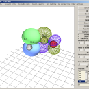
Multiwfn is a user-friendly, powerful and flexible program that aims for general wavefunction analysis. Multiwfn accepts several kinds of files as wavefunction input: .wfn/.wfx (Conventional / Extended PROAIM wavefunction file), .31~.40
(NBO plot file), .fch (Gaussian formatted check file). ...
| Author | sobereva |
| Released | 2020-08-14 |
| Filesize | 15.90 MB |
| Downloads | 553 |
| OS | Windows Vista, Windows Vista x64, Windows 7, Windows 7 x64, Windows 8, Windows 8 x64, Windows 10, Windows 10 x64, Windows 11 |
| Installation | Instal And Uninstall |
| Keywords | wavefunction analysis, topology analysis, molecular structure, analysis, analize, wavefunction |
| Users' rating (22 rating) |
Multiwfn Free Download - we do not host any Multiwfn torrent files or links of Multiwfn on rapidshare.com, depositfiles.com, megaupload.com etc. All Multiwfn download links are direct Multiwfn download from publisher site or their selected mirrors.
| 3.7 | Aug 14, 2020 | New Release | |
| 3.6 | May 21, 2019 | New Release | A very powerful and easy-to-use RESP module is added into main function 7 (Population analysis). It can calculate the well-known ElectroStatic Potential (RESP) charge proposed in J. Phys. Chem., 97, 10269 (1993), and can also calculate ESP fitting charges under various customized conditions such as atomic equivalence constraint and fragment charge constraint. Multiple conformation is fully supported. See Section 3.9.16 for detailed introduction and Section 4.7.7 for examples. This module should be able to bring a revolution in the field of RESP charge derivation. Energy decomposition analysis based on UFF/AMBER/GAFF molecular forcefield is supported as subfunction 1 of main function 21. See corresponding introduction in Section 3.24.1 and examples in Section 4.21.1 of the manual. |
| 2.4 | May 23, 2012 | New Release | · Fixed a bug introduced by Version 2.2.1 (that is Multiwfn crashes during reading the .fch files produced by unrestricted calculation with cartesian basis functions) · Fixed a bug in the interface for selecting the interbasin surfaces to be generated · A serious bug in reading the .fch files produced by unrestricted calculation with spherical basis functions is solved · Merz-Kollmann charge is supported in population module · Option 10 is added to topology analysis module, this is a small tool used to calculate Shannon aromaticity index |


