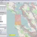
Mobile Atlas Creator 2.2.1 freeware

Mobile Atlas Creator is a small, simple, Java based application specially designed to help you create atlases for TrekBuddy. Basically this software will create offline atlases for GPS handhelds and cell phone applications like TrekBuddy, AndNav and other Android and WindowsCE based applications. ...

Author Fredrik Moller
Released 2021-06-02
Filesize 15.00 MB
Downloads 2252
OS Windows XP, Windows Vista, Windows Vista x64, Windows 7, Windows 7 x64, Windows 8, Windows 8 x64, Windows 10, Windows 10 x64, Linux
Installation Instal And Uninstall
Keywords create atlas, generate atlas, atlas creator, generator, generate, create
Users' rating
(28 rating)
Mobile Atlas CreatorCADWindows XP, Windows Vista, Windows Vista x64, Windows 7, Windows 7 x64, Windows 8, Windows 8 x64, Windows 10, Windows 10 x64, Linux
Mobile Atlas Creator - tool Freeware Download Notice

Mobile Atlas Creator Free Download - we do not host any Mobile Atlas Creator torrent files or links of Mobile Atlas Creator on rapidshare.com, depositfiles.com, megaupload.com etc. All Mobile Atlas Creator download links are direct Mobile Atlas Creator download from publisher site or their selected mirrors.

Mobile Atlas Creator freeware - The Latest User Reviews
Mobile Atlas Creator freeware - The Latest Versions History
2.2.1 Jun 2, 2021 New Release
2.1.3 Rev 24 Apr 14, 2020 New Release Minimum supported Java version increased to Java 8 (1.8)
"mapFile must not be null" error when creating an atlas
Save settings to settings.xml in UTF-8 format (fix for #324)
Map creation error with JPEG (Garmin Custom and others) (fix for #326)
2.1.2 Rev 24 Oct 11, 2019 New Release Minimum supported Java version increased to Java 8 (1.8)
"mapFile must not be null" error when creating an atlas
Save settings to settings.xml in UTF-8 format (fix for #324)
Map creation error with JPEG (Garmin Custom and others) (fix for #326)

Most popular CAD freeware downloads

FilterPro Desktop

3.1.0.23446 freeware download

... to Excel. FilterPro active filter design tool allows designers to create and edit active filter designs easily using the Filter Design Wizard. Users ...

Model Air Design

1.8 freeware download

... to create airplane models. It's a modern software tool for model aircraft design. Model Air Design is for every person, young or old, who has ...

New Version

ProfiCAD

12.4.4 freeware download

... to learn and use, it is a professional tool used by a wide range of customers. FEATURES: easy to learn and use - ...

Woodland Potential Calculator

2.01 freeware download

... England commissioned a bespoke data collection and presentation tool for calculating the potential for increasing the extent of tree cover across the north west of ...

Home Plan Viewer

2.2.2.2 freeware download

Use it to load, view, and print plans drawn by Home Plan Pro. Send it to friends, family, or co-workers so they can see what you ...

Gmsh

4.13.1 freeware download

... design goal is to provide a simple meshing tool for academic problems with parametric input and advanced ... which features a built-in CAD engine and post-processing tool, enabling you to generate 3D mesh. It comes ...

QGIS for Linux

3.36.1 freeware download

... Improved vector and attribute editing · Improved measure tools with area measuring · Attribute searching · New ... libraries in mapping applications · Improved MapServer export tool · Vector layer transparency and antialiasing · GRASS ...

PreviSat

6.1.0.3 freeware download

... position of artificial satellites in real time. The tool is able to offer predictions about satellites’ passes and Iridium flares. PreviSat offers support for two ...

PolyRootsRB for Linux

1.3 freeware download

PolyRootsRB finds the roots of a polynomial to any chosen accuracy using Laguerre's Method. The coefficients of the polynomial can be real or complex. PolyRootsRB uses ...

TNTmips

20240404 freeware download

... with associated database attributes. It provides all the tools you need to view, create, edit, georeference, interpret, ... type of geospatial data. TNTmips provides professional geospatial tools in a single package at an affordable price ...