Panoply for Mac 5.4.3 freeware

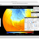
Panoply for Mac is an utility that enable user to plot raster image. Depending on the data, it can draw global longitude-latitude images or pole-to-pole latitude-vertical images.Panoply is a cross-platform application which plots geo-gridded arrays from netCDF, HDF and GRIB datasets. The utility can also combine two arrays and can project the analysis using more than 100 maps. ...

Author Robert B. Schmunk
Released 2024-06-24
Filesize 36.40 MB
Downloads 758
OS Mac OS X
Installation Instal And Uninstall
Keywords plot raster image, longitude image, pole-to-pole image, raster image, rasterize, raster
Users' rating
(28 rating)
Panoply for MacCADMac OS X
Panoply for Mac - time tables Freeware Download Notice

Panoply for Mac Free Download - we do not host any Panoply for Mac torrent files or links of Panoply for Mac on rapidshare.com, depositfiles.com, megaupload.com etc. All Panoply for Mac download links are direct Panoply for Mac download from publisher site or their selected mirrors.

Panoply for Mac freeware - The Latest User Reviews
Panoply for Mac freeware - The Latest Versions History
5.4.3 Jun 24, 2024 New Release
5.4.1 Jun 1, 2024 New Release
5.4.0 May 11, 2024 New Release

Most popular CAD freeware downloads

Panoply for Mac

5.4.3 freeware download

... color contour plots of geo-referenced latitude-longitude, latitude-vertical, longitude-vertical, time-latitude or time-vertical arrays sliced from 2D or larger multidimensional variables. ... lon-lat map plots. Use any of numerous color tables for the scale colorbar, or apply your own ...

OpenAPC

2.5 freeware download

... locked to one particular operating system for all time. In worst case you can transfer your existing project files to an other system easily, there ...

KMWin

1.52 freeware download

... for graphical presentation of results from Kaplan-Meier survival time analysis. The programme is an interface and intended ... Main Window - Creation and management of survival time plots, modification of curve properties as colours, line ...

TNTatlas

2024 B20240606 freeware download

... disaster relief, health and plant protection, or other time-critical management activities. TNTatlas, from MicroImages, Inc. is ... browsed its pages of maps, pictures, and reference tables. Where the map runs off the side of ...

SolidFace 3D CAD PTV

24.0.0.X freeware download

... of parametric variables via commands, questions, or variable tables; Logical conditions If-then-else; Parametric generation of bill of materials with associative link with Excel and Access ...

TNTatlas for Mac OS X

2024 B20240508 freeware download

... disaster relief, health and plant protection, or other time-critical management activities. TNTatlas, from MicroImages, Inc. is ... browsed its pages of maps, pictures, and reference tables. Where the map runs off the side of ...

DSI Studio

.59 freeware download

... information as cost function. Visualization: · Real time 3D tractography presentation · Tracks selection, deletion, cutting function · 3D Regions presentation · ODF visualization ...