- Freeware
- - Graphic Apps
- - CAD
- - BimRoad
BimRoad Plus freeware
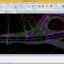
Parametric road design. The world's first software for automatic interchange design. Three-dimensional alignment design. Real-time interchange redesign considering design standards by changing the main alignment. All type of interchange design using user defined connection road. Automatic connection road plan by editing nose point. Automatic correction of road plan design element using parametric method. ...
| Author | HaneeSoft |
| Released | 2015-01-01 |
| Filesize | 232.65 MB |
| Downloads | 277 |
| OS | Win2000, Windows XP, Windows 7 x32, Windows 7 x64, Windows 8, Windows 10, WinServer, WinOther, Windows Vista, Windows Vista x64 |
| Installation | Install and Uninstall |
| Keywords | Road design, Interchange design, Alignment, Earthwork |
| Users' rating (15 rating) |
BimRoad Free Download - we do not host any BimRoad torrent files or links of BimRoad on rapidshare.com, depositfiles.com, megaupload.com etc. All BimRoad download links are direct BimRoad download from publisher site or their selected mirrors.
| Plus | Jan 1, 2015 | New Release | Road design. Topography creation. Plane design. Profile Design. Interchange automatic design. Cross section design. Earthwork. Hydraulics. Report / Drawing. |


