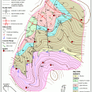
TNTatlas for Mac OS X 2024 B20240508 freeware

TNTatlas is a powerful free geodata viewer that lets you publish and distribute your maps and geospatial data — from a single geodata file to complex map layouts prepared using TNTmips. TNTatlas lets you display massive sized geodata and will directly display numerous file formats including shapefiles, GeoTIFF, JP2, PNG, MrSID, DXF, and DWG. ...

Author MicroImages, Inc.
Released 2024-05-08
Filesize 87.90 MB
Downloads 761
OS Mac OS X
Installation Instal And Uninstall
Keywords geospatial viewer, view atlas, visualize geospatial data, atlas, map, viewer
Users' rating
(45 rating)
TNTatlas for Mac OS XCADMac OS X
TNTatlas for Mac OS X - take that Freeware Download Notice

TNTatlas for Mac OS X Free Download - we do not host any TNTatlas for Mac OS X torrent files or links of TNTatlas for Mac OS X on rapidshare.com, depositfiles.com, megaupload.com etc. All TNTatlas for Mac OS X download links are direct TNTatlas for Mac OS X download from publisher site or their selected mirrors.

TNTatlas for Mac OS X freeware - The Latest User Reviews
TNTatlas for Mac OS X freeware - The Latest Versions History
2024 B202405 May 8, 2024 New Release
2023 B202303 Mar 23, 2023 New Release
2022 B202212 Dec 7, 2022 New Release

Most popular CAD freeware downloads

Freeship Plus

3.43+ freeware download

... resistance and power prediction under serial diagrams, is that the designer uses not that serial diagram, or combination of the incompatible data ... not correspond to any serial diagram you can take advantage of calculations according to modelling tests of ...

Webots PRO for Mac OS X

R2023a freeware download

... each robot. With Webots PRO, you take advantage of a proven technology that has been codeveloped by the Swiss Federal Institute ...

JMARS

3.1.5 freeware download

JMARS is an acronym that stands for Java Mission-planning and Analysis for Remote ... here are a few of them: * Take multiple datasets (thermal inertia, mineral composition, digital elevations, ...

5 freeware award

nanoCAD

5.1.2524.2017 freeware download

... use in mind. Migration to nanoCAD will hardly take you more than 10 minutes since nanoCAD delivers: ... has a traditional CAD application programming interface (API) that allows developing independent nanoCAD based applications and additional ...

Xtreme Calculations

32.0 freeware download

... comes with a nice set of extra features that are not related to the precise calculations it ... to the time off you may want to take from your work. Thus, you get Calculation Speed ...

TNTatlas

2024 B20240606 freeware download

TNTatlas is a powerful free geodata viewer that lets you publish and distribute your maps and ... from MicroImages, Inc. is the free publication tool that lets you organize, distribute, and present the spatial ...

JMARS for Windows

3.1.5 freeware download

JMARS is an acronym that stands for Java Mission-planning and Analysis for Remote ... here are a few of them: * Take multiple datasets (thermal inertia, mineral composition, digital elevations, ...

Webots PRO

R2023a freeware download

... each robot. With Webots PRO, you take advantage of a proven technology that has been codeveloped by the Swiss Federal Institute ...

TNTatlas for Mac OS X

2024 B20240508 freeware download

TNTatlas is a powerful free geodata viewer that lets you publish and distribute your maps and ... from MicroImages, Inc. is the free publication tool that lets you organize, distribute, and present the spatial ...

TrueSpace

7.61 freeware download

... designed to be a fully-featured 3D authoring package that will let you model, texture, light, animate and ... from a wide variety of formats, letting you take existing objects and use them in Virtual Earth. ...