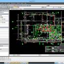
nanoCAD 5.1.2524.2017 freeware

nanoCAD - easy-to-use free CAD software delivering great user experience by providing classic interface and native .dwg support. Being ultimate in 2D design tools, nanoCAD has been built to deliver design and project documentation regardless of the industry or enterprise. And above all, nanoCAD is free to use and share. At home and in business. ...

Author Nanosoft
Released 2013-12-23
Filesize 372.05 MB
Downloads 1196
OS Win2000, Windows XP, Windows 7 x32, Windows 7 x64, Windows 8, Windows 10, WinServer, WinOther, Windows Vista, Windows Vista x64
Installation Install and Uninstall
Keywords free cad software, CAD, dwg-compatible, nanocad, autocad compatible
Users' rating
(22 rating)
nanoCADCADWin2000, Windows XP, Windows 7 x32, Windows 7 x64, Windows 8, Windows 10, WinServer, WinOther, Windows Vista, Windows Vista x64
nanoCAD - tables Freeware Download Notice

nanoCAD Free Download - we do not host any nanoCAD torrent files or links of nanoCAD on rapidshare.com, depositfiles.com, megaupload.com etc. All nanoCAD download links are direct nanoCAD download from publisher site or their selected mirrors.

nanoCAD freeware - The Latest User Reviews
nanoCAD freeware - The Latest Versions History
5.1.2524.201 Dec 23, 2013 Major Update • Optimized support for DirectX graphics.
• Support for AutoCAD 2013/2014 version DWG files.
• Enter mathematical expressions in numeric fields of Properties dialog.
• AutoComplete in Command line with more options.
• LineWeight Settings dialog.
• Improved 3D view commands
5.0.2000 Oct 27, 2013 Major Update • Optimized support for DirectX graphics.
• Support for AutoCAD 2013/2014 version DWG files.
• Enter mathematical expressions in numeric fields of Properties dialog.
• AutoComplete in Command line with more options.
• LineWeight Settings dialog.
• Improved 3D view commands
5.0 Oct 22, 2013 Major Update • Optimized support for DirectX graphics.
• Support for AutoCAD 2013/2014 version DWG files.
• Enter mathematical expressions in numeric fields of Properties dialog.
• AutoComplete in Command line with more options.
• LineWeight Settings dialog.
• Improved 3D view commands

Most popular CAD freeware downloads

Panoply for Mac

5.4.3 freeware download

... lon-lat map plots. Use any of numerous color tables for the scale colorbar, or apply your own custom ACT, CPT, or RGB color table. Save ...

GOM Inspect

7.5 SR1 freeware download

... ISO 1101 and ASME Y14.5 standards Reporting: screenshots, tables, PDFs, ... Polygon mesh generation and processing GOM Inspect automatically converts point cloud ...

tinyFLP

1.30 freeware download

... automatic peak selection and scoring of AFLP data tables witten by Wolfgang Arthofer, University of Innsbruck. Austria. ...

Thuban for Mac OS X

1.0.1-3 freeware download

... for detailed analysis and query results or entire tables can be exported. Localisation The Thuban User Interface is available for various languages: ...

SketchEl

1.60 freeware download

... of SketchEl allows viewing and editing of simple tables of data, for which each column is a common scalar type (string, int, real, boolean) or ...

nanoCAD

5.1.2524.2017 freeware download

... and editing 2D and 3D vector primitives, texts, tables, blocks, graphical technical documentation display and print settings using either a model or a sheet. - ...

OpenAPC

2.5 freeware download

OpenAPC is an Open Source APC (Advanced Process Control) solution that is highly flexible and configurable and covers a wide range of automation, visualization and process ...

QGIS

3.36.1 freeware download

... "QGIS": · Support for spatially enabled PostgreSQL tables using PostGIS · Support for ESRI shapefiles and other vector formats support by the OGR library ...

QGIS for Linux

3.36.1 freeware download

... "QGIS": · Support for spatially enabled PostgreSQL tables using PostGIS · Support for ESRI shapefiles and other vector formats support by the OGR library ...

TNTatlas for Mac OS X

2024 B20240508 freeware download

... browsed its pages of maps, pictures, and reference tables. Where the map runs off the side of ... statistics, you looked in another section for data tables or special maps. While paper atlases and ...