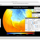
Panoply for Mac 5.4.3 freeware

Panoply for Mac is an utility that enable user to plot raster image. Depending on the data, it can draw global longitude-latitude images or pole-to-pole latitude-vertical images.Panoply is a cross-platform application which plots geo-gridded arrays from netCDF, HDF and GRIB datasets. The utility can also combine two arrays and can project the analysis using more than 100 maps. ...

Author Robert B. Schmunk
Released 2024-06-24
Filesize 36.40 MB
Downloads 809
OS Mac OS X
Installation Instal And Uninstall
Keywords plot raster image, longitude image, pole-to-pole image, raster image, rasterize, raster
Users' rating
(30 rating)
Panoply for MacCADMac OS X
Panoply for Mac - table Freeware Download Notice

Panoply for Mac Free Download - we do not host any Panoply for Mac torrent files or links of Panoply for Mac on rapidshare.com, depositfiles.com, megaupload.com etc. All Panoply for Mac download links are direct Panoply for Mac download from publisher site or their selected mirrors.

Panoply for Mac freeware - The Latest User Reviews
Panoply for Mac freeware - The Latest Versions History
5.4.3 Jun 24, 2024 New Release
5.4.1 Jun 1, 2024 New Release
5.4.0 May 11, 2024 New Release

Most popular CAD freeware downloads

Panoply for Mac

5.4.3 freeware download

... lon-lat map plots. Use any of numerous color tables for the scale colorbar, or apply your own custom ACT, CPT, or RGB color table. Save plots to disk GIF, JPEG, PNG or ...

QGIS for Linux

3.36.1 freeware download

... "QGIS": · Support for spatially enabled PostgreSQL tables using PostGIS · Support for ESRI shapefiles and ... Map composer · Identify features · Display attribute table · Select features · Label features · Persistent ...

JMARS

3.1.5 freeware download

... vector data on the map or in a table. * Use vector processing tools to calculate properties like line bearing or polygonal area. * An ...

5 freeware award

JMARS for Windows

3.1.5 freeware download

... vector data on the map or in a table. * Use vector processing tools to calculate properties like line bearing or polygonal area. * An ...

QGIS

3.36.1 freeware download

... "QGIS": · Support for spatially enabled PostgreSQL tables using PostGIS · Support for ESRI shapefiles and ... Map composer · Identify features · Display attribute table · Select features · Label features · Persistent ...

tinyFLP

1.30 freeware download

... automatic peak selection and scoring of AFLP data tables witten by Wolfgang Arthofer, University of Innsbruck. Austria. ...

Thuban for Windows

1.2.2 freeware download

... and Annotation # Legend Editor and Classification # Table Queries and Joins # Projection Support # Printing ... map and to each separate layer. Table Management The table view lists all records ...

ZeGrapher for Linux

2.0.0 freeware download

... colors (background, axes, functions...), speed, precision, font size... Table of values for functions and sequences Plotting functions and sequences with a parameter. Easy navigation on ...

QGIS for Mac

3.36.1 freeware download

... "QGIS": · Support for spatially enabled PostgreSQL tables using PostGIS · Support for ESRI shapefiles and ... Map composer · Identify features · Display attribute table · Select features · Label features · Persistent ...

Gephi

0.10.1 freeware download

... · Save/Load project files · Use the Data Table view to browse and edit data Modular: · Gephi 0.7 architecture is modular and therefore ...