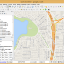
QGIS for Mac 3.36.1 freeware

QGIS supports vector, raster, and database formats and lets you browse and create map data on your computer.
QGIS supports many common spatial data formats (e.g. ESRI ShapeFile, geotiff). QGIS supports plugins to do things like display tracks from your GPS.
QGIS aims to be an easy to use GIS, providing common functions and features. The initial goal was to provide a GIS data viewer. ...

Author Gary Sherman
Released 2024-03-26
Filesize 1600.00 MB
Downloads 771
OS Mac OS X
Installation Instal And Uninstall
Keywords geographic information system, map creator, map viewer, GIS, geographic information, create, QGIS for Mac
Users' rating
(31 rating)
QGIS for MacCADMac OS X
QGIS for Mac - system tools Freeware Download Notice

QGIS for Mac Free Download - we do not host any QGIS for Mac torrent files or links of QGIS for Mac on rapidshare.com, depositfiles.com, megaupload.com etc. All QGIS for Mac download links are direct QGIS for Mac download from publisher site or their selected mirrors.

QGIS for Mac freeware - The Latest User Reviews
QGIS for Mac freeware - The Latest Versions History
3.36.1 Mar 26, 2024 New Release
3.36.2 Apr 25, 2024 New Release
3.36.1 Mar 26, 2024 New Release

Most popular CAD freeware downloads

JMARS

3.1.5 freeware download

... for Remote Sensing. It is a geospatial information system (GIS) developed by ASU's Mars Space Flight Facility to provide mission planning and data-analysis tools to NASA's orbiters, instrument team members, students of ...

5 freeware award

QGIS

3.36.1 freeware download

... Improved vector and attribute editing · Improved measure tools with area measuring · Attribute searching · New legend structure · Refactoring of API to allow ...

DipTrace Free

4.3.0.0 freeware download

... Layout features a shape-based autorouter, high-speed/differential signal routing tools and 3D PCB Preview/Export. Schematic Capture works with ... your design. DipTrace provides manual and automatic placement tools and is capable of routing single- and multilayer ...

TNTmips

20240404 freeware download

TNTmips software is a complete Geographic Information System (GIS) that lets you work with virtually any ... with associated database attributes. It provides all the tools you need to view, create, edit, georeference, interpret, ...

QGIS for Mac

3.36.1 freeware download

... Improved vector and attribute editing · Improved measure tools with area measuring · Attribute searching · New legend structure · Refactoring of API to allow ...

QGIS for Linux

3.36.1 freeware download

... Improved vector and attribute editing · Improved measure tools with area measuring · Attribute searching · New legend structure · Refactoring of API to allow ...

SDMetrics

2.5 freeware download

... identify potential design problems early on predict relevant system qualities such as fault-proneness or maintainability to better focus your review and testing efforts increase system quality and quality assurance effectiveness, find more faults ...

NetLogo

6.0.4 freeware download

... run simulations for various phenomena, providing 3D modeling tools and multiple visualization options. Generated models can be ... data from multiple parallel runs of a model System Dynamics Modeler NetLogo 3D for modeling 3D worlds ...

DirectMath

3.2.3 freeware download

... an easy to use mathematical editor, a computation system, and a collection of powerful technical drawing tools. The DirectMath editor is a simple, streamlined editor ... end for the Mathematica and Maxima computer algebra systems. DirectMath uses a powerful built-in pattern matching system ...

Graph Streaming

0.7.0.12 freeware download

... leverage its power to visualize and monitor complex systems or enterprise data in real-time. Moreover, the idea ... standardized API could bring interoperability with other available tools for graph and network analysis, as they could ...