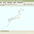
wxGIS Portable 0.4.1 freeware

... that is able to store the geographic coordinate systems in folders. It also includes a vector file export utility and a tool for correcting the orthographic data from raster TIFF files. ...

Author Dmitry Barishnikov
Released 2012-11-15
Filesize 9.70 MB
Downloads 344
OS Windows XP, Windows Vista, Windows Vista x64, Windows 7, Windows 7 x64
Installation Instal And Uninstall
Keywords GIS catalog, manage geography data, geographic coordinate system, manage, catalog, geography
Users' rating
(8 rating)
wxGIS PortableCADWindows XP, Windows Vista, Windows Vista x64, Windows 7, Windows 7 x64
wxGIS Portable - system Freeware Download Notice

wxGIS Portable Free Download - we do not host any wxGIS Portable torrent files or links of wxGIS Portable on rapidshare.com, depositfiles.com, megaupload.com etc. All wxGIS Portable download links are direct wxGIS Portable download from publisher site or their selected mirrors.

wxGIS Portable freeware - The Latest User Reviews
wxGIS Portable freeware - The Latest Versions History
0.4.1 Nov 15, 2012 New Release · The DEM interpolation switch (bilinear or cubic) in orthocorrect tool
· Russian interface translation
· Rename item support
· Automatic rename output files in batch export
· The ortho-correction tool become more accurate and speedy

Most popular CAD freeware downloads

FilterPro Desktop

3.1.0.23446 freeware download

... all-pass phase shift/time delay filters to help ease system design. ...

ProfiCAD

12.4.4 freeware download

... just drag symbols onto the drawing low system requirements - runs on any PC with Windows 2000 and higher supports Unicode - can ...

Woodland Potential Calculator

2.01 freeware download

... was considerably extended and adopted as a national system. It is currently being used to compile the National Woodland Potential dataset for the whole of ...

QGIS for Linux

3.36.1 freeware download

QGIS is a professional GIS application that is built on top of and proud to be itself Free and Open Source Software (FOSS). QGIS supports ...

Freeship Plus

3.43+ freeware download

... of service conditions of a ship. The analyzable system includes a hull, appendages, a propeller and the ... Calculations in FREE!ship Plus are based on the systematic serial tests of models of the ships and ...

SBSI Visual

1.5.0 freeware download

SBSI or Systems Biology Software Infrastructure is a handy suite of software tools specially designed for systems biology. It includes parallelized numerical algorithms, and a

TNTmips

20240404 freeware download

TNTmips software is a complete Geographic Information System (GIS) that lets you work with virtually any ... data types and a multitude of Coordinate Reference Systems. Include layers in a wide variety of external ...

Jmol

14.31.53 freeware download

... Automatically adopts the language of the user's operating system, if it is among the translations available. You can change to another language if desired. · ...

Graph Streaming

0.7.0.12 freeware download

... leverage its power to visualize and monitor complex systems or enterprise data in real-time. Moreover, the idea ... the increasing level of connectivity and cooperation between systems, for a system that aim to be interoperable, ...

SimThyr for Mac OS X

4.0.0.837 freeware download

... on a parametrically isomorphic model of the overall system. Applications of this program cover research, including development of hypotheses, and education of students in biology ...

5 freeware award