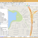
QGIS 3.36.1 freeware

QGIS supports vector, raster, and database formats and lets you browse and create map data on your computer.
QGIS supports many common spatial data formats (e.g. ESRI ShapeFile, geotiff). QGIS supports plugins to do things like display tracks from your GPS.
QGIS aims to be an easy to use GIS, providing common functions and features. The initial goal was to provide a GIS data viewer. ...

Author Gary Sherman
Released 2024-03-26
Filesize 1000.00 MB
Downloads 770
OS Windows XP, Windows Vista, Windows Vista x64, Windows 7, Windows 7 x64, Windows 8, Windows 8 x64, Windows 10, Windows 10 x64, Windows 11
Installation Instal And Uninstall
Keywords geographic information system, map creator, map viewer, GIS, geographic information, create, QGIS
Users' rating
(28 rating)
QGISCADWindows XP, Windows Vista, Windows Vista x64, Windows 7, Windows 7 x64, Windows 8, Windows 8 x64, Windows 10, Windows 10 x64, Windows 11
QGIS - system information Freeware Download Notice

QGIS Free Download - we do not host any QGIS torrent files or links of QGIS on rapidshare.com, depositfiles.com, megaupload.com etc. All QGIS download links are direct QGIS download from publisher site or their selected mirrors.

QGIS freeware - The Latest User Reviews
QGIS freeware - The Latest Versions History
3.36.1 Mar 26, 2024 New Release
3.36.2 Apr 25, 2024 New Release
3.36.1 Mar 26, 2024 New Release

Most popular CAD freeware downloads

QGIS for Mac

3.36.1 freeware download

QGIS is a professional GIS application that is built on top of and proud to be itself Free and Open Source Software (FOSS). QGIS supports ...

JMARS

3.1.5 freeware download

... Analysis for Remote Sensing. It is a geospatial information system (GIS) developed by ASU's Mars Space Flight Facility ... the THEMIS, MOC, CTX, HiRISE, CRISM, Viking Imaging System, HRSC, and OMEGA instruments; mosaics from THEMIS, Viking, ...

5 freeware award

JMARS for Windows

3.1.5 freeware download

... Analysis for Remote Sensing. It is a geospatial information system (GIS) developed by ASU's Mars Space Flight Facility ... the THEMIS, MOC, CTX, HiRISE, CRISM, Viking Imaging System, HRSC, and OMEGA instruments; mosaics from THEMIS, Viking, ...

Jmol

14.31.53 freeware download

... based application designed to display various 3D chemical information. Jmol's features include reading a variety of ... Automatically adopts the language of the user's operating system, if it is among the translations available. You ...

Jmol for Linux

14.31.53 freeware download

... based application designed to display various 3D chemical information. Jmol's features include reading a variety of ... Automatically adopts the language of the user's operating system, if it is among the translations available. You ...

CityCAD Viewer

2.7.0 freeware download

... without having the main application installed on your system. However, CityCAD Viewer is limited to displaying the ... phases, and add costs, values and some movement information. ...

DX Central

2.20 freeware download

... provides images of the sun and vital, timely information about solar activity in a way that is concise and easy to use. Information displayed is from NASA, NIST, I Torsomo Objservatory ...

SwitcherPro Desktop

3.17.0.0 freeware download

... The Library Manager allows you to view system parts and define your own parts to use ... desktop Calculate efficiency Calculate loop responses View stress information on all key parts in the design Customize ...

wxGIS

0.2.0 freeware download

... manage and to organize multiple types of geographic information. The program has an Explorer-like interface that is able to store the geographic coordinate systems in folders. It also includes a vector file ...

wxGIS Portable

0.4.1 freeware download

... manage and to organize multiple types of geographic information. The program has an Explorer-like interface that is able to store the geographic coordinate systems in folders. It also includes a vector file ...