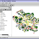
Thuban for Windows 1.2.2 freeware

Thuban is an Interactive Geographic Data Viewer with the following features:

# Vector Data Support: Shapefile, PostGIS Layer and OGR
# Raster Data Support: GeoTIFF Layer and GDAL
# Comfortable Map Navigation
# Object Identification and Annotation
# Legend Editor and Classification
# Table Queries and Joins
# Projection Support
# Printing and Vector Export
# API for Add-Ons (Extensions) ...

Author Thuban Development Team
Released 2009-08-18
Filesize 11.22 MB
Downloads 447
OS Windows 2000, Windows 2003, Windows XP, Windows Vista
Installation Instal And Uninstall
Keywords geographic data viewer, gis viewer, analyze geographic information, information, geographic, viewer
Users' rating
(12 rating)
Thuban for WindowsCADWindows 2000, Windows 2003, Windows XP, Windows Vista
Thuban for Windows - survey Freeware Download Notice

Thuban for Windows Free Download - we do not host any Thuban for Windows torrent files or links of Thuban for Windows on rapidshare.com, depositfiles.com, megaupload.com etc. All Thuban for Windows download links are direct Thuban for Windows download from publisher site or their selected mirrors.

Thuban for Windows freeware - The Latest User Reviews
Thuban for Windows freeware - The Latest Versions History
1.2.2 Aug 18, 2009 New Release

Most popular CAD freeware downloads

UCL Depthmap

0.8.0 freeware download

... MID import · OpenStreetMap, Tiger Line and Ordnance Survey ITN layer loaders · Text, SVG and EPS export ...

Thuban for Windows

1.2.2 freeware download

... systems as used by the EPSG (European Petroleum Survey Group). For full flexibility projections can be assigned to the map and to each separate ...

Thuban for Mac OS X

1.0.1-3 freeware download

... systems as used by the EPSG (European Petroleum Survey Group). For full flexibility projections can be assigned to the map and to each separate ...

Thuban for Linux

1.2.2 freeware download

... systems as used by the EPSG (European Petroleum Survey Group). For full flexibility projections can be assigned to the map and to each separate ...

Translev

4.16.0 freeware download

... VERTOBS datasets for submission to the National Geodetic Survey (NGS). The program includes many built-in functions such as predicting temperature differences, refaction corrections, rod corrections ...