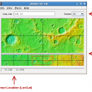
JMARS 3.1.5 freeware

JMARS is an acronym that stands for Java Mission-planning and Analysis for Remote Sensing. It is a geospatial information system (GIS) developed by ASU's Mars Space Flight Facility to provide mission planning and data-analysis tools to NASA's orbiters, instrument team members, students of all ages, and the general public. ...

Author Arizona State University
Released 2014-08-12
Filesize 50.00 MB
Downloads 734
OS Linux, Mac OS X
Installation Instal And Uninstall
Keywords mission analysis, geospatial information, GIS analysis, mission, analysis, GIS
Users' rating
(21 rating)
JMARSCADLinux, Mac OS X
Our rating 5 freeware award
JMARS - surface Freeware Download Notice

JMARS Free Download - we do not host any JMARS torrent files or links of JMARS on rapidshare.com, depositfiles.com, megaupload.com etc. All JMARS download links are direct JMARS download from publisher site or their selected mirrors.

JMARS freeware - The Latest User Reviews
JMARS freeware - The Latest Versions History
3.1.5 Aug 12, 2014 New Release - In JMARS, locate the "Options" tab at the top of the screen, click it
- Click "Check for Updates"
3.0.4 Jun 7, 2013 New Release - minor change that will allow users to use Body->reset layers to reset layers to JMARS default/startup state
- minor bug fix in the interaction of the Main view and Panner views
- accuracy of crater layer settings improved when saving crater layers as part of a saved session
- more graceful error handling when loading a saved session
- removed the ESRI option from the list for loading/saving in the shape layer. The Geo tools ESRI option is the replacement
- a fix for a drawing issue in the TES layer on Mac OS X running Java 7
- lower right corner coordinates added to the high resolution export tool including new UI functionality for setting export height and width
- update to how image corners (lat/lon) are specified in high resolution export
- added CSV export and look and feel changes to the Investigate tool
- improved communication between the Stamp Layer and backend databases
- Add Layer UI look and feel improvements
- ease of use changes to crater counting layer for small bodies
1.25 Aug 22, 2011 New Release General:
· The Look and Feel of JMARS should now be more consistent with the platform it is on.

Map Layer:
· Added a "View Citations" button to the source section of the Map Layer focus panel.
· Custom Map Upload fix to prevent

Most popular CAD freeware downloads

Gwyddion

2.66 freeware download

... kernel · statistical functions: Ra, RMS, projected and surface area, inclination, histograms, 1D and 2D correlation functions, PSDF, 1D and 2D angular distributions, Minkowski functionals, ...

Gwyddion for Linux

2.66 freeware download

... kernel · statistical functions: Ra, RMS, projected and surface area, inclination, histograms, 1D and 2D correlation functions, PSDF, 1D and 2D angular distributions, Minkowski functionals, ...

MeshMagic 3D Modeling Software Free

2.00 freeware download

... meshes. With MeshMagic you can select entire objects, surfaces triangles, lines, or points. Use MeshMagic 3D to transform a 2D outline into A 3D object. ...

DAVID-Laserscanner

5.6.0.2037 freeware download

... automatically calculates 3D coordinates of the scanned object surface. See our gallery to get an impression of the software. To obtain a complete 360 ...

Aqsis Renderer for Windows

1.8.2 freeware download

... motion blur, NURBS, procedural plugins, programmable shading, subdivision surfaces, subpixel displacements and more. The Aqsis tools ... Occlusion * Arbitrary Output Variables (AOV) * Subdivision Surfaces (SDS) * High quality texture mapping * Level ...

Aqsis Renderer for Mac OS X

1.8.2 freeware download

... motion blur, NURBS, procedural plugins, programmable shading, subdivision surfaces, subpixel displacements and more. The Aqsis tools ... Occlusion * Arbitrary Output Variables (AOV) * Subdivision Surfaces (SDS) * High quality texture mapping * Level ...

CueMol

2.2.3.442 freeware download

... density (CCP4, CNS , and BRIX format), MSMS surface data, and GRASP electrostatic potential map. ...

JMARS

3.1.5 freeware download

... registered multilayer image. * Make topographic profiles, extract surface temperatures (day or night), plot footprints and render ... Correlate mineral compositions with topographic data. * Combine surface roughness data with thermal inertia data. * Contour ...

5 freeware award

Pro Yacht

1.0.0.1 freeware download

PolyCAD brings together the best selection of hull surface design techniques together within a user interface which ... The software supports the direct manipulation of NURBS surfaces, parametric hull generation and advanced techniques such as ...

Multiwfn

3.7 freeware download

... and can be viewed in terms of iso surface. Setting up grid is very flexible and convenient. ... terms of 3D or plane graph. Interbasin · surfaces can be drawn. · Checking and modifying wavefunction. ...