Navigation:
- Freeware
- - Graphic Apps
- - CAD
- - UCL Depthmap
UCL Depthmap 0.8.0 freeware
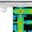
... single software platform to perform a set of spatial network analyses designed to understand social processes within the built environment. It works at a variety of scales from building through small urban to whole cities or states. ...
| Author | University College London |
| Released | 2020-11-08 |
| Filesize | 35.10 MB |
| Downloads | 1375 |
| OS | Windows XP, Windows Vista, Windows Vista x64, Windows 7, Windows 7 x64, Windows 8, Windows 8 x64, Windows 10, Windows 10 x64, Windows 11 |
| Installation | Instal And Uninstall |
| Keywords | urban environment, urban map, spatial network analysis, environment, map, analysis |
| Users' rating (27 rating) |
UCL Depthmap Free Download - we do not host any UCL Depthmap torrent files or links of UCL Depthmap on rapidshare.com, depositfiles.com, megaupload.com etc. All UCL Depthmap download links are direct UCL Depthmap download from publisher site or their selected mirrors.
| 0.8.0 | Nov 8, 2020 | New Release | General: Allow for pushing values from shapemaps (axial maps, segment maps) to VGA Fix VGA map connections export Make drawing to segment conversion faster Test and fix shape removal for axial and data maps Allow pushing the Ref or Key value to another layer Fix MIF/MID import (allow for empty columns, PR #369) Fix diagonal line handling on VGA map fill (PR #326, thanks Piotr Piastucki!) Change C++ standard to 17 Graphical User Interface (GUI): Highlight shapes and pixels on hover (can be disabled in the settings) Allow inserting any number in the table (PR #356) Fix a case where the app would crash with multiple unlinking in VGA (PR #328) Fix convex map hover and selection (PR #368) Allow generating multiple isovists by importing a CSV file Fix a case where VGA progress bar would end, but analysis would still be going (PR #323) |
| 0.7.0 | Jun 7, 2019 | New Release | |
| 0.30 | Sep 18, 2014 | New Release |


