Navigation:
PAST for Mac OS X 4.03 freeware
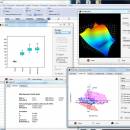
Past is free software for scientific data analysis, with functions for data manipulation, plotting, univariate and multivariate statistics, ecological analysis, time series and spatial analysis, morphometrics and stratigraphy. Past packs together numerous data manipulation techniques that prove to be very useful when analyzing scientific data. ...
| Author | Oyvind Hammer |
| Released | 2020-06-02 |
| Filesize | 9.90 MB |
| Downloads | 419 |
| OS | Mac OS X |
| Installation | Instal And Uninstall |
| Keywords | data analysis, scatter, paleontology, analyze, 3D scatter, statistical function, analysis |
| Users' rating (16 rating) |
PAST for Mac OS X Free Download - we do not host any PAST for Mac OS X torrent files or links of PAST for Mac OS X on rapidshare.com, depositfiles.com, megaupload.com etc. All PAST for Mac OS X download links are direct PAST for Mac OS X download from publisher site or their selected mirrors.
| 4.03 | Jun 2, 2020 | New Release | Redundancy Analysis (RDA) One-way PerMANOVA now includes repeated-measures (paired) design. Color selector for rows reverted to old (pre 4.02) type (new type optional in the Row colors/symbols module) Diversity module: Bootstrapping made optional, and speed improvement Permutation test added to repeated-measured ANOVA NMDS now reports distances to group centroids Individual rarefaction now includes option for plotting all samples at smallest N Mann-Kendall test now reports the z statistic with sign (not absolute value) Help text added to 16 modules Bug fix: Changepoint analysis crashed on Mac Bug fix: Bivariate linear regression with log-log transformation: reported residuals were not transformed Bug fix: Incorrect plotting of convex hulls in some special cases Bug fix: Delete uninformative rows did not work for genetic data |
| 4.02 | Apr 11, 2020 | New Release | The first 64-bit version of Past, allowing even larger data volumes Google Maps and scripting disabled, hopefully to return in next version Polar plot Bug fix: XY graph crashed for non-numerical data values |
| 4.01 | Mar 6, 2020 | New Release | Scripting re-introduced Google Maps re-introduced Bubble plot and bar chart options added to Google Maps Help text added to 42 modules 3D surface and parametric surface background changed to white Bug fix: Nonlinear fitting: Zero-constant option did not work for power and exponential functions Bug fix: Pie chart crashed for all-zero columns Bug fix: Occasional crash in Short-time Fourier Transform Bug fix: SVG export of matrix plot gave interpolated image even with interpolation turned off Bug fix: “Replace” function very slow for big data sets Bug fix: “Model->Species packing” crashed for all-zero and singleton columns Bug fix: “Model->Bivariate” crashed when restarting without first closing window |


