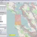
Mobile Atlas Creator 2.2.1 freeware

... help you create atlases for TrekBuddy. Basically this software will create offline atlases for GPS handhelds and cell phone applications like TrekBuddy, AndNav and other Android and WindowsCE based applications. ...

Author Fredrik Moller
Released 2021-06-02
Filesize 15.00 MB
Downloads 2246
OS Windows XP, Windows Vista, Windows Vista x64, Windows 7, Windows 7 x64, Windows 8, Windows 8 x64, Windows 10, Windows 10 x64, Linux
Installation Instal And Uninstall
Keywords create atlas, generate atlas, atlas creator, generator, generate, create
Users' rating
(26 rating)
Mobile Atlas CreatorCADWindows XP, Windows Vista, Windows Vista x64, Windows 7, Windows 7 x64, Windows 8, Windows 8 x64, Windows 10, Windows 10 x64, Linux
Mobile Atlas Creator - software zoom Freeware Download Notice

Mobile Atlas Creator Free Download - we do not host any Mobile Atlas Creator torrent files or links of Mobile Atlas Creator on rapidshare.com, depositfiles.com, megaupload.com etc. All Mobile Atlas Creator download links are direct Mobile Atlas Creator download from publisher site or their selected mirrors.

Mobile Atlas Creator freeware - The Latest User Reviews
Mobile Atlas Creator freeware - The Latest Versions History
2.2.1 Jun 2, 2021 New Release
2.1.3 Rev 24 Apr 14, 2020 New Release Minimum supported Java version increased to Java 8 (1.8)
"mapFile must not be null" error when creating an atlas
Save settings to settings.xml in UTF-8 format (fix for #324)
Map creation error with JPEG (Garmin Custom and others) (fix for #326)
2.1.2 Rev 24 Oct 11, 2019 New Release Minimum supported Java version increased to Java 8 (1.8)
"mapFile must not be null" error when creating an atlas
Save settings to settings.xml in UTF-8 format (fix for #324)
Map creation error with JPEG (Garmin Custom and others) (fix for #326)

Most popular CAD freeware downloads

ShareCAD

2.0 freeware download

... formats in any browser without installing any additional software; - zoom and rotate images, change display modes and use ...

OpalCalc

1.94 freeware download

... to Aqualia for creating a wonderful piece of software, but I couldn't wait for a Windows port, ... tutorial · Full colour coding · Multiple undo/redo, zoom in/out, etc. · Numerous built-in functions · Percentages ...

ArcReader

10.5.0 B6491 freeware download

... documents can be viewed up close using the zooming functions of ArcReader. It comes with a host ... was once limited to those with advanced GIS software on their computers. With ArcReader, you can ...

Mobile Atlas Creator

2.2.1 freeware download

... SQLite (Android) [Nokia] Sports Tracker Touratech QV (Windows software, commercial) TrekBuddy (J2ME, Android) u-blox and others Prepare atlases consisting of multiple layers, different map sources ...

Mobile Atlas Creator for Mac OS X

2.2.1 freeware download

... SQLite (Android) [Nokia] Sports Tracker Touratech QV (Windows software, commercial) TrekBuddy (J2ME, Android) u-blox and others Prepare atlases consisting of multiple layers, different map sources ...

Digimizer

6.4.0 freeware download

Digimizer is an easy-to-use and flexible image analysis software package that allows precise manual measurements as well ... files. Image manipulation Resize Crop Rotate, flip Zoom Adjust contrast & brightness Contrast auto fix Stretch ...

OpalCalc Portable

1.94 freeware download

... to Aqualia for creating a wonderful piece of software, but I couldn't wait for a Windows port, ... tutorial · Full colour coding · Multiple undo/redo, zoom in/out, etc. · Numerous built-in functions · Percentages ...

Elshayal Smart

23.02 freeware download

Elshayal Smart is the first Arabian GIS software that is completely developed by Arabian developers team and independent of any commercial software package. Download Maps from Google Earth, and ...

ZeGrapher

2.0.0 freeware download

... a parameter. Easy navigation on the graph: move, zoom, scale... Print: choose scale, graph size, ..., in centimeters Export: image or PDF Draw derivatives and ...

ZeGrapher for Linux

2.0.0 freeware download

... a parameter. Easy navigation on the graph: move, zoom, scale... Print: choose scale, graph size, ..., in centimeters Export: image or PDF Draw derivatives and ...