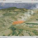
Virtual Terrain Project for Mac OS X and Linux 1.1 110804 freeware

... of VTP is to foster the creation of tools for easily constructing any part of the real world in interactive, 3D digital form.

This goal will require a synergetic convergence of the fields of CAD, GIS, visual simulation, surveying and remote sensing. VTP gathers information and tracks progress in areas such as procedural scene construction, feature extraction, and rendering algorithms. ...

Author Ben Discoe
Released 2011-09-08
Filesize 2.20 MB
Downloads 376
OS Linux, Mac OS X
Installation Instal And Uninstall
Keywords libraries, demos, data, open source, VirtualTerrain Project, CAD, GIS, VTP
Users' rating
(9 rating)
Virtual Terrain Project for Mac OS X and LinuxCADLinux, Mac OS X
Virtual Terrain Project for Mac OS X and Linux - software tools Freeware Download Notice

Virtual Terrain Project for Mac OS X and Linux Free Download - we do not host any Virtual Terrain Project for Mac OS X and Linux torrent files or links of Virtual Terrain Project for Mac OS X and Linux on rapidshare.com, depositfiles.com, megaupload.com etc. All Virtual Terrain Project for Mac OS X and Linux download links are direct Virtual Terrain Project for Mac OS X and Linux download from publisher site or their selected mirrors.

Virtual Terrain Project for Mac OS X and Linux freeware - The Latest User Reviews
Virtual Terrain Project for Mac OS X and Linux freeware - The Latest Versions History
1.1 110804 Sep 8, 2011 New Release Enviro:
Exposed support for more stereo modes: Horizontal and Vertical split.
Options to enable joystick and spacenavigator, rather than just always using them if present.
Smooth continuous update when making buildings.
Option to constrain building point to right angles. Deter user from making bad points.
Made support for Collada (.dae) more explicit in the UI.
Display the version number in the startup dialog.
Added 'every N meters' option to Contour dialog, making it significantly more useful.
Changed 'Move' mode to use Alt modifier key for up/down, to be consistent.
Fixed issues with: support for elevation grids with non-unit vertical scale; removing layers from a terrain; saving snapshot and high-resolution snapshot; buildings with a Geographic CRS; draping of 2D polylines on terrain with vertical exaggeration.

VTBuilder:
Raw layers: Draw polygon holes as dotted lines to tell them from outer edges.

Most popular CAD freeware downloads

LTspice IV

24.0.12 freeware download

LTspice IV is a high performance SPICE simulator, schematic capture and waveform viewer with enhancements and models for easing the simulation of switching regulators. Our enhancements ...

MarvinSketch

23.16.0 freeware download

... and user-defined templates and context-sensitive popup menus. The software contains a rich feature set that includes many editing tools as well as support for bond and atom ...

sRNA Workbench

4.5.1 freeware download

... is a new simple to use, downloadable sRNA software package based on algorithms developed for the original ... on each tool can be found at the tools pages. Alternatively, an extensive help menu is available ...

Model Air Design

2.4 freeware download

Model Air Design is a cross-platform software utility built specifically for helping users create 3D-model aircrafts. While other dedicated CAD tools come packed with many editing capabilities and parameters ...

MuniWin

2.1.13 freeware download

The C-Munipack is the software package, which offers the complete solution for reduction ... up with the Munipack package, the programs and tools have the same name, but in difference to ...

SketchEl

1.60 freeware download

... Features : Easy to use interactive tools for placing atoms and bonds. Tools are multipurposed in order to provide convenient access ...

Engauge Digitizer for Windows

12.0 freeware download

Engauge Digitizer - Digitizing software This open source, digitizing software converts an image file showing a graph or ... digitized data that can be used by other tools such as Microsoft Excel and Gnumeric. ...

5 freeware award

Engauge Digitizer for Mac OS X

12.0 freeware download

Engauge Digitizer - Digitizing software This open source, digitizing software converts an image file showing a graph or ... digitized data that can be used by other tools such as Microsoft Excel and Gnumeric. ...

5 freeware award

ArcReader

10.5.0 B6491 freeware download

... of ArcReader. It comes with a host of tools that include a markup pen, a highlighter, a ... was once limited to those with advanced GIS software on their computers. With ArcReader, you can ...

3D Architecture by LiveCAD

2.1 freeware download

... 3D tour - Use a range of advanced tools to modify the land area - Automatic roof ... and the level of lighting - Easy-to-use drawing-aid tools for high-level precision (help lines, grid) - Real-time ...