Engauge Digitizer for Windows 12.0 freeware

Engauge Digitizer - Digitizing software

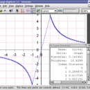
This open source, digitizing software converts an image file showing a graph or map, into numbers. The image file can come from a scanner, digital camera or screenshot. The numbers can be read on the screen, and written or copied to a spreadsheet.

The process starts with an image file containing a graph or map. The final result is digitized ...

Author Mark Mitchell
Released 2019-08-19
Filesize 10.60 MB
Downloads 902
OS Windows 2000, Windows 2003, Windows XP, Windows Vista, Windows Vista x64
Installation Instal And Uninstall
Keywords digitize image, image to number, process image, digitize, convert, digitizer
Users' rating
(21 rating)
Engauge Digitizer for WindowsCADWindows 2000, Windows 2003, Windows XP, Windows Vista, Windows Vista x64
Our rating 5 freeware award
Engauge Digitizer for Windows - software gps Freeware Download Notice

Engauge Digitizer for Windows Free Download - we do not host any Engauge Digitizer for Windows torrent files or links of Engauge Digitizer for Windows on rapidshare.com, depositfiles.com, megaupload.com etc. All Engauge Digitizer for Windows download links are direct Engauge Digitizer for Windows download from publisher site or their selected mirrors.

Engauge Digitizer for Windows freeware - The Latest User Reviews
Engauge Digitizer for Windows freeware - The Latest Versions History
12.0 Aug 19, 2019 New Release
10.4 Oct 11, 2017 New Release Show warning message when grid line maximum is exceed (#244)
CSV export files have double quotes on fields with internal commas (#243)
Status bar shows all of text for right-to-left languages (#240)
5.1 Dec 24, 2012 New Release Fix for broken point matching, and control of the x/theta axis label.

Most popular CAD freeware downloads

Engauge Digitizer for Windows

12.0 freeware download

Engauge Digitizer - Digitizing software This open source, digitizing software converts an image file showing a graph or ... but you do not have an odometer or GPS unit. However, you do have a map. ...

5 freeware award

Mobile Atlas Creator

2.2.1 freeware download

... source (GPL) program which creates offline atlases for GPS handhelds and cell phone applications like TrekBuddy, AndNav ... a large number of different (mobile) applications and GPS handhelds: AFTrack (Symbian) AlpineQuest (Android) AndNav (Android) BackCountry ...

Mobile Atlas Creator for Mac OS X

2.2.1 freeware download

... source (GPL) program which creates offline atlases for GPS handhelds and cell phone applications like TrekBuddy, AndNav ... a large number of different (mobile) applications and GPS handhelds: AFTrack (Symbian) AlpineQuest (Android) AndNav (Android) BackCountry ...

Engauge Digitizer for Mac OS X

12.0 freeware download

Engauge Digitizer - Digitizing software This open source, digitizing software converts an image file showing a graph or ... but you do not have an odometer or GPS unit. However, you do have a map. ...

5 freeware award

QGIS

3.36.1 freeware download

... proud to be itself Free and Open Source Software (FOSS). QGIS supports vector, raster, and database ... to do things like display tracks from your GPS. QGIS aims to be an easy to ...

QGIS for Linux

3.36.1 freeware download

... proud to be itself Free and Open Source Software (FOSS). QGIS supports vector, raster, and database ... to do things like display tracks from your GPS. QGIS aims to be an easy to ...

Engauge Digitizer for Linux

12.0 freeware download

Engauge Digitizer - Digitizing software This open source, digitizing software converts an image file showing a graph or ... but you do not have an odometer or GPS unit. However, you do have a map. ...

TNTmips

20240404 freeware download

TNTmips software is a complete Geographic Information System (GIS) that ... reference image; place control points with coordinates from GPS devices ... Import and export an unsurpassed ...

TNTmips for Mac OS X

20240111 freeware download

... reference image; place control points with coordinates from GPS devices. Import and export an unsurpassed number ... and triangulated irregular networks (TINs), respectively. TNTgis software on macOS runs under the XQuartz X Window ...

Elshayal Smart

23.02 freeware download

Elshayal Smart is the first Arabian GIS software that is completely developed by Arabian developers team and independent of any commercial software package. Download Maps from Google Earth, and ...