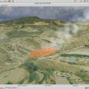
Virtual Terrain Project for Windows 1.1 110804 freeware

... of VTP is to foster the creation of tools for easily constructing any part of the real world in interactive, 3D digital form.

This goal will require a synergetic convergence of the fields of CAD, GIS, visual simulation, surveying and remote sensing. VTP gathers information and tracks progress in areas such as procedural scene construction, feature extraction, and rendering algorithms. ...

Author Ben Discoe
Released 2011-09-08
Filesize 1.00 MB
Downloads 451
OS Windows 2000, Windows 2003, Windows XP, Windows Vista
Installation Instal And Uninstall
Keywords libraries, demos, data, open source, VirtualTerrain Project, CAD, GIS, VTP
Users' rating
(11 rating)
Virtual Terrain Project for WindowsCADWindows 2000, Windows 2003, Windows XP, Windows Vista
Virtual Terrain Project for Windows - software development tools Freeware Download Notice

Virtual Terrain Project for Windows Free Download - we do not host any Virtual Terrain Project for Windows torrent files or links of Virtual Terrain Project for Windows on rapidshare.com, depositfiles.com, megaupload.com etc. All Virtual Terrain Project for Windows download links are direct Virtual Terrain Project for Windows download from publisher site or their selected mirrors.

Virtual Terrain Project for Windows freeware - The Latest User Reviews
Virtual Terrain Project for Windows freeware - The Latest Versions History
1.1 110804 Sep 8, 2011 New Release Enviro:
Exposed support for more stereo modes: Horizontal and Vertical split.
Options to enable joystick and spacenavigator, rather than just always using them if present.
Smooth continuous update when making buildings.
Option to constrain building point to right angles. Deter user from making bad points.
Made support for Collada (.dae) more explicit in the UI.
Display the version number in the startup dialog.
Added 'every N meters' option to Contour dialog, making it significantly more useful.
Changed 'Move' mode to use Alt modifier key for up/down, to be consistent.
Fixed issues with: support for elevation grids with non-unit vertical scale; removing layers from a terrain; saving snapshot and high-resolution snapshot; buildings with a Geographic CRS; draping of 2D polylines on terrain with vertical exaggeration.

VTBuilder:
Raw layers: Draw polygon holes as dotted lines to tell them from outer edges.

Most popular CAD freeware downloads

Pro Yacht

1.0.0.1 freeware download

... extensive manipulation of geometry in 3D dimensions. The software supports the direct manipulation of NURBS surfaces, parametric ... data is rarely supported in modern hull design tools. PolyCAD incorporates a range of powerful polyline processing ...

USeq

8.9.6 freeware download

USeq is a collection of software tools for for both low and high level analysis ... FDR estimations. USeq is under continuous development at the Huntsman Cancer Institute in the Utah ...

CADEMIA for Mac

3.0 RC3 freeware download

Existing software tools for the planning process have severe limitations: They ... a limited exertion of influence on the further development. As a solution, a new platform for ...

nanoCAD

5.1.2524.2017 freeware download

nanoCAD - easy-to-use free CAD software delivering great user experience by providing classic interface ... .dwg support. Being the ultimate in 2D design tools, nanoCAD has been built to deliver design and ...

GOM Inspect

7.5 SR1 freeware download

GOM Inspect - Powerful, free software for inspection and mesh processing GOM Inspect is a free 3D inspection and mesh processing software for dimensional analysis of 3D point clouds and ...

Electronic Cancer System Studio

1.0.0.1 freeware download

A computational model development and simulation environment for cancer systems biology. ELECANS ... of the art in the multi agent simulation tools available for computational modeling of tumorigenesis in a ...

SDMetrics

2.5 freeware download

... assurance effectiveness, find more faults earlier and save development cost refine your LOC or effort estimates for ... The later a fault is found in the development process, the more expensive it is to fix. ...

Thuban for Windows

1.2.2 freeware download

... The FreeGIS Project provides an overview of Free Software GIS projects. Many valuable and highly sophisticated tools exist, but there is still a need for ... Thuban makes use of several Free GIS Software components and is itself the basis of advanced ...

Thuban for Mac OS X

1.0.1-3 freeware download

... The FreeGIS Project provides an overview of Free Software GIS projects. Many valuable and highly sophisticated tools exist, but there is still a need for ... Thuban makes use of several Free GIS Software components and is itself the basis of advanced ...

Thuban for Linux

1.2.2 freeware download

... The FreeGIS Project provides an overview of Free Software GIS projects. Many valuable and highly sophisticated tools exist, but there is still a need for ... Thuban makes use of several Free GIS Software components and is itself the basis of advanced ...