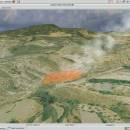
Virtual Terrain Project for Windows 1.1 110804 freeware

... tracks progress in areas such as procedural scene construction, feature extraction, and rendering algorithms. ...

Author Ben Discoe
Released 2011-09-08
Filesize 1.00 MB
Downloads 455
OS Windows 2000, Windows 2003, Windows XP, Windows Vista
Installation Instal And Uninstall
Keywords libraries, demos, data, open source, VirtualTerrain Project, CAD, GIS, VTP
Users' rating
(13 rating)
Virtual Terrain Project for WindowsCADWindows 2000, Windows 2003, Windows XP, Windows Vista
Virtual Terrain Project for Windows - software construction Freeware Download Notice

Virtual Terrain Project for Windows Free Download - we do not host any Virtual Terrain Project for Windows torrent files or links of Virtual Terrain Project for Windows on rapidshare.com, depositfiles.com, megaupload.com etc. All Virtual Terrain Project for Windows download links are direct Virtual Terrain Project for Windows download from publisher site or their selected mirrors.

Virtual Terrain Project for Windows freeware - The Latest User Reviews
Virtual Terrain Project for Windows freeware - The Latest Versions History
1.1 110804 Sep 8, 2011 New Release Enviro:
Exposed support for more stereo modes: Horizontal and Vertical split.
Options to enable joystick and spacenavigator, rather than just always using them if present.
Smooth continuous update when making buildings.
Option to constrain building point to right angles. Deter user from making bad points.
Made support for Collada (.dae) more explicit in the UI.
Display the version number in the startup dialog.
Added 'every N meters' option to Contour dialog, making it significantly more useful.
Changed 'Move' mode to use Alt modifier key for up/down, to be consistent.
Fixed issues with: support for elevation grids with non-unit vertical scale; removing layers from a terrain; saving snapshot and high-resolution snapshot; buildings with a Geographic CRS; draping of 2D polylines on terrain with vertical exaggeration.

VTBuilder:
Raw layers: Draw polygon holes as dotted lines to tell them from outer edges.

Most popular CAD freeware downloads

SCaVis

2.3 freeware download

... engineers and students. The program incorporates many open-source software packages into a coherent interface using the concept ... based on the JAIDA classes for data manipulation, construction of histograms and functions. SCaVis includes high-level data ...

5 freeware award

Axdea 3D CAD, BIM based IBS Score

1.1.6 freeware download

Axdea 3D CAD, BIM-based IBS Score Software. Axdea is a FREE 3D CAD, BIM-based IBS Score software and was released by Innovacia Sdn Bhd on 26th March 2018 during the International Construction Week (ICW) at the Kuala Lumpur Convention Centre, ...

Axdea

1.1.6 freeware download

Axdea 3D CAD, BIM-based IBS Score Software. Axdea is a FREE 3D CAD, BIM-based IBS Score software and was released by Innovacia Sdn Bhd on 26th March 2018 during the International Construction Week (ICW) at the Kuala Lumpur Convention Centre, ...

SolidFace 3D CAD PTV

24.0.0.X freeware download

Professional 3D Modeling Software (CAD) PTV - A CAD rebuilt with everything ... Assembly and Drawing module; Communication with other CAD software via standard X_T, X_B, DWG, DXF, STL, BMP, ...

Virtual Terrain Project for Windows

1.1 110804 freeware download

... tracks progress in areas such as procedural scene construction, feature extraction, and rendering algorithms. VTP writes and supports a set of software tools, including an interactive runtime environment (VTP Enviro). ...

Virtual Terrain Project for Mac OS X and Linux

1.1 110804 freeware download

... tracks progress in areas such as procedural scene construction, feature extraction, and rendering algorithms. VTP writes and supports a set of software tools, including an interactive runtime environment (VTP Enviro). ...

GOM Inspect

7.5 SR1 freeware download

GOM Inspect - Powerful, free software for inspection and mesh processing GOM Inspect is a free 3D inspection and mesh processing software for dimensional analysis of 3D point clouds and ...