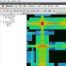
UCL Depthmap 0.8.0 freeware

Depthmap is a single software platform to perform a set of spatial network analyses designed to understand social processes within the built environment. It works at a variety of scales from building through small urban to whole cities or states. ...

Author University College London
Released 2020-11-08
Filesize 35.10 MB
Downloads 1375
OS Windows XP, Windows Vista, Windows Vista x64, Windows 7, Windows 7 x64, Windows 8, Windows 8 x64, Windows 10, Windows 10 x64, Windows 11
Installation Instal And Uninstall
Keywords urban environment, urban map, spatial network analysis, environment, map, analysis
Users' rating
(27 rating)
UCL DepthmapCADWindows XP, Windows Vista, Windows Vista x64, Windows 7, Windows 7 x64, Windows 8, Windows 8 x64, Windows 10, Windows 10 x64, Windows 11
UCL Depthmap - single Freeware Download Notice

UCL Depthmap Free Download - we do not host any UCL Depthmap torrent files or links of UCL Depthmap on rapidshare.com, depositfiles.com, megaupload.com etc. All UCL Depthmap download links are direct UCL Depthmap download from publisher site or their selected mirrors.

UCL Depthmap freeware - The Latest User Reviews
UCL Depthmap freeware - The Latest Versions History
0.8.0 Nov 8, 2020 New Release General:
Allow for pushing values from shapemaps (axial maps, segment maps) to VGA
Fix VGA map connections export
Make drawing to segment conversion faster
Test and fix shape removal for axial and data maps
Allow pushing the Ref or Key value to another layer
Fix MIF/MID import (allow for empty columns, PR #369)
Fix diagonal line handling on VGA map fill (PR #326, thanks Piotr Piastucki!)
Change C++ standard to 17
Graphical User Interface (GUI):
Highlight shapes and pixels on hover (can be disabled in the settings)
Allow inserting any number in the table (PR #356)
Fix a case where the app would crash with multiple unlinking in VGA (PR #328)
Fix convex map hover and selection (PR #368)
Allow generating multiple isovists by importing a CSV file
Fix a case where VGA progress bar would end, but analysis would still be going (PR #323)
0.7.0 Jun 7, 2019 New Release
0.30 Sep 18, 2014 New Release

Most popular CAD freeware downloads

TNTatlas for Mac OS X

2024 B20240508 freeware download

... your maps and geospatial data — from a single geodata file to complex map layouts prepared using TNTmips. TNTatlas lets you display massive sized geodata ...

MarvinSketch

23.16.0 freeware download

... charge, valence, radicals and isotopes to each atom. Single, double, triple bonds and aromatic forms are supported. Moreover, using wedge bonds user can assign stereochemistry ...

DipTrace Free

4.3.0.0 freeware download

... automatic placement tools and is capable of routing single- and multilayer circuit boards automatically with a full control over the layer stackup. Smart manual routing ...

CiDess

4.28 freeware download

... the components at any angle - Support both single and double side PCB - Support ground plane on each side - Support CMS - Advanced ...

MagicPlot Student

2.9.3 freeware download

... enough and consistent. Advantages: * Compact: Single file ~2 MB * Multilevel undo function for all actions * Useful plot navigation and scaling ...

MagicPlot Student for Mac OS X

2.9.3 freeware download

... enough and consistent. Advantages: * Compact: Single file ~2 MB * Multilevel undo function for all actions * Useful plot navigation and scaling ...

MagicPlot Student for Linux

2.9.3 freeware download

... enough and consistent. Advantages: * Compact: Single file ~2 MB * Multilevel undo function for all actions * Useful plot navigation and scaling ...

Thuban for Windows

1.2.2 freeware download

... legend: The layers objects can be grouped by single values or ranges. Visibility and symbols can be edited per group. Automatic Classification Thuban ...

enCIFer for Linux

1.4 freeware download

... corrupting the strict syntax. enCIFer operates on single or multi-block CIFs allowing you to: Identify ... CIF without corrupting the strict syntax, for both single data items and data loops Supplement the data ...

TNTatlas

2024 B20240606 freeware download

... your maps and geospatial data — from a single geodata file to complex map layouts prepared using TNTmips. TNTatlas lets you display massive sized geodata ...