QGIS for Mac 3.36.1 freeware

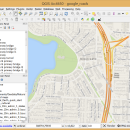
QGIS supports vector, raster, and database formats and lets you browse and create map data on your computer.
QGIS supports many common spatial data formats (e.g. ESRI ShapeFile, geotiff). QGIS supports plugins to do things like display tracks from your GPS.
QGIS aims to be an easy to use GIS, providing common functions and features. The initial goal was to provide a GIS data viewer. ...

Author Gary Sherman
Released 2024-03-26
Filesize 1600.00 MB
Downloads 746
OS Mac OS X
Installation Instal And Uninstall
Keywords geographic information system, map creator, map viewer, GIS, geographic information, create, QGIS for Mac
Users' rating
(23 rating)
QGIS for MacCADMac OS X
QGIS for Mac - single number Freeware Download Notice

QGIS for Mac Free Download - we do not host any QGIS for Mac torrent files or links of QGIS for Mac on rapidshare.com, depositfiles.com, megaupload.com etc. All QGIS for Mac download links are direct QGIS for Mac download from publisher site or their selected mirrors.

QGIS for Mac freeware - The Latest User Reviews
QGIS for Mac freeware - The Latest Versions History
3.36.1 Mar 26, 2024 New Release
3.36.2 Apr 25, 2024 New Release
3.36.1 Mar 26, 2024 New Release

Most popular CAD freeware downloads

QGIS for Mac

3.36.1 freeware download

... daily GIS data viewing needs. QGIS supports a number of raster and vector data formats, with new support easily added using the plugin architecture. ...

UCL Depthmap

0.8.0 freeware download

Depthmap is a single software platform to perform a set of spatial ... used to assess the visual accessibility in a number of ways. It can produce point isovists, that ...

Open3DALIGN

2.28 freeware download

... for each compound of the dataset either the single conformation originally imported or the conformational databases previously ... The QMD search is accomplished running a number of short molecular dynamics runs (using the MMFF94 ...

TNTmips

20240404 freeware download

... data. TNTmips provides professional geospatial tools in a single package at an affordable price without costly add-ons. ... devices ... Import and export an unsurpassed number of raster, geometric, and database file formats; convert ...

Mobile Atlas Creator

2.2.1 freeware download

... atlas Mobile Atlas Creator can use a large number of different online maps such as OpenStreetMap, Google ... Features: Create offline atlases for a large number of different (mobile) applications and GPS handhelds: AFTrack ...

Thuban for Windows

1.2.2 freeware download

... legend: The layers objects can be grouped by single values or ranges. Visibility and symbols can be ... uniform distribution and * quantiles. The number of groups is flexible, a ramp of symbols ...

QGIS

3.36.1 freeware download

... daily GIS data viewing needs. QGIS supports a number of raster and vector data formats, with new support easily added using the plugin architecture. ...

QGIS for Linux

3.36.1 freeware download

... daily GIS data viewing needs. QGIS supports a number of raster and vector data formats, with new support easily added using the plugin architecture. ...

CiDess

4.28 freeware download

... editor : - Easy to use - Large number of component types featured - 3D view - ... the components at any angle - Support both single and double side PCB - Support ground plane ...

Open3DALIGN x64

2.28 freeware download

... for each compound of the dataset either the single conformation originally imported or the conformational databases previously ... The QMD search is accomplished running a number of short molecular dynamics runs (using the MMFF94 ...