CiDess 4.28 freeware

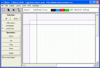
... the components at any angle - Support both single and double side PCB - Support CMS - ... page generation to publish your PCB - Featured file manager with search engine, find and sort easily your PCB files ...

Author CiDess
Released 2018-04-17
Filesize 5.15 MB
Downloads 3047
OS Windows 2000, Windows XP, Windows 2003, Vista, Seven, 8, 10
Installation No Install Support
Keywords Free PCB Layout editor 3D
Users' rating
(17 rating)
CiDessCADWindows 2000, Windows XP, Windows 2003, Vista, Seven, 8, 10
CiDess - single file Freeware Download Notice

CiDess Free Download - we do not host any CiDess torrent files or links of CiDess on rapidshare.com, depositfiles.com, megaupload.com etc. All CiDess download links are direct CiDess download from publisher site or their selected mirrors.

CiDess freeware - The Latest User Reviews
CiDess freeware - The Latest Versions History
4.28 Apr 17, 2018 New Release
4.25 Sep 1, 2017 New Release
3.2 Dec 26, 2010 New Release

Most popular CAD freeware downloads

QGIS for Linux

3.36.1 freeware download

... formats support by the OGR library · MapInfo files · GRASS integration, including view, edit, and analysis ... and multiband RGB) · Export to Mapserver map file · Digitizing support · Map overview · Plugins ...

TNTmips

20240404 freeware download

... data. TNTmips provides professional geospatial tools in a single package at an affordable price without costly add-ons. ... an unsurpassed number of raster, geometric, and database file formats; convert between data types; and link to ...

TNTatlas for Mac OS X

2024 B20240508 freeware download

... your maps and geospatial data — from a single geodata file to complex map layouts prepared using TNTmips. TNTatlas ... massive sized geodata and will directly display numerous file formats including shapefiles, GeoTIFF, JP2, PNG, MrSID, DXF, ...

CiDess

4.28 freeware download

... the components at any angle - Support both single and double side PCB - Support ground plane ... PCB can be save as 3DG and STL file - PCB drilling with CNC machine - Special ...

TNTatlas

2024 B20240606 freeware download

... your maps and geospatial data — from a single geodata file to complex map layouts prepared using TNTmips. TNTatlas ... massive sized geodata and will directly display numerous file formats including shapefiles, GeoTIFF, JP2, PNG, MrSID, DXF, ...

FreeMedForms

1.0.0 freeware download

... specialties and even veterinary profession. The patient file is fully editable. It is built with an XML file that you can modify to suit best for ...

QGIS

3.36.1 freeware download

... formats support by the OGR library · MapInfo files · GRASS integration, including view, edit, and analysis ... and multiband RGB) · Export to Mapserver map file · Digitizing support · Map overview · Plugins ...

Br3D

1.3 freeware download

... weight, fast free 3D Viewer Supports various 3D file format. Read : DWG, DXF, IFC, IFCZIP, STL, ... Memo Measure Measure Area Measure Volume Multi View Single View 11 12 22 View Mode Perspective View ...

Open3DALIGN for Linux

2.28 freeware download

... 1. A dataset is imported as SDF file 2. Optionally, for each compound of the dataset ... for each compound of the dataset either the single conformation originally imported or the conformational databases previously ...

QGIS for Mac

3.36.1 freeware download

... formats support by the OGR library · MapInfo files · GRASS integration, including view, edit, and analysis ... and multiband RGB) · Export to Mapserver map file · Digitizing support · Map overview · Plugins ...