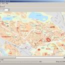
GpsTools Studio 2.3.1 build 227 freeware

GpsTools Studio is a useful tool for the GpsGate Server users that want to create custom maps in order to use them for tracking the GPS devices. The program allows you to import a map from a popular image file and to export it to a compatible format. ...

Author Franson Technology
Released 2012-11-21
Filesize 3.80 MB
Downloads 403
OS Windows XP, Windows Vista, Windows Vista x64, Windows 7, Windows 7 x64, Windows 8, Windows 8 x64, Windows 10, Windows 10 x64
Installation Instal And Uninstall
Keywords create map, import GpsGate map, scale image, map, creator, create
Users' rating
(12 rating)
GpsTools StudioCADWindows XP, Windows Vista, Windows Vista x64, Windows 7, Windows 7 x64, Windows 8, Windows 8 x64, Windows 10, Windows 10 x64
GpsTools Studio - scale Freeware Download Notice

GpsTools Studio Free Download - we do not host any GpsTools Studio torrent files or links of GpsTools Studio on rapidshare.com, depositfiles.com, megaupload.com etc. All GpsTools Studio download links are direct GpsTools Studio download from publisher site or their selected mirrors.

GpsTools Studio freeware - The Latest User Reviews
GpsTools Studio freeware - The Latest Versions History
2.3.1 build Nov 21, 2012 New Release

Most popular CAD freeware downloads

FilterPro Desktop

3.1.0.23446 freeware download

... adjust passive element tolerances and view response variations; scale passive component values; and view and export filter performance data to Excel. FilterPro active ...

Panoply for Mac

5.4.3 freeware download

... browse between datasets and catalogues, to adjust the scale range, to customize labels, vectors, to overlay masks, ... Use any of numerous color tables for the scale colorbar, or apply your own custom ACT, CPT, ...

Gmsh

4.13.1 freeware download

... can use elementary entities (e.g. add, translate, rotate, scale), physical groups (coherence, reload, edit file), define one, two and three dimensions, as well as run ...

Gwyddion for Linux

2.66 freeware download

... dimension determination · force-distance curve fitting · axes scale callibration · merging and immersion of images · tip modelling, blind estimation, dilation and erosion ...

LTplus AI-Tool V10

10 freeware download

... 1:1 and in CENTIMETER. External drawings could be scaled in meter. You should only draw on a scale of 1:1. In LTplus the CENTIMETER is used ...

UCL Depthmap

0.8.0 freeware download

... built environment. It works at a variety of scales from building through small urban to whole cities or states. At each scale, the aim of the software is to produce ...

Caliper2PC

2.7.3.15 freeware download

... tools in the same way as linear glass scales. For this purpose digital scale readouts with mounting brackets are available in different lengths. In small CNC machines these scales can serve as reference givers and tool length ...

Pro Yacht

1.0.0.1 freeware download

... be generated or hard copy templates printed, to scale, to aid physical modelling. Manipulation of hull ... has been reviewed and the basic translate, rotate, scale and mirror operations have been completely rewritten to ...

BabaCAD

2.0.0 freeware download

... well with lwpolylines with bulges) Plot with scale, layout and multiple viewport support Use different colors, line types, line widths by block or ...

Geogiga Front End

9.0 freeware download

... Pick first breaks Swap traces Shift a trace Scale, mute, average, or reverse seismic traces inside/outside any shape of defined region Gain control: automatic gain ...