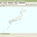
wxGIS Portable 0.4.1 freeware

... manage and to organize multiple types of geographic information. The program has an Explorer-like interface that is able to store the geographic coordinate systems in folders. It also includes a vector file export utility and a tool for correcting the orthographic data from raster TIFF files. ...

Author Dmitry Barishnikov
Released 2012-11-15
Filesize 9.70 MB
Downloads 342
OS Windows XP, Windows Vista, Windows Vista x64, Windows 7, Windows 7 x64
Installation Instal And Uninstall
Keywords GIS catalog, manage geography data, geographic coordinate system, manage, catalog, geography
Users' rating
(5 rating)
wxGIS PortableCADWindows XP, Windows Vista, Windows Vista x64, Windows 7, Windows 7 x64
wxGIS Portable - s m a r t information Freeware Download Notice

wxGIS Portable Free Download - we do not host any wxGIS Portable torrent files or links of wxGIS Portable on rapidshare.com, depositfiles.com, megaupload.com etc. All wxGIS Portable download links are direct wxGIS Portable download from publisher site or their selected mirrors.

wxGIS Portable freeware - The Latest User Reviews
wxGIS Portable freeware - The Latest Versions History
0.4.1 Nov 15, 2012 New Release · The DEM interpolation switch (bilinear or cubic) in orthocorrect tool
· Russian interface translation
· Rename item support
· Automatic rename output files in batch export
· The ortho-correction tool become more accurate and speedy

Most popular CAD freeware downloads

TNTatlas for Mac OS X

2024 B20240508 freeware download

... JP2, PNG, MrSID, DXF, and DWG. Geospatial information plays a growing part in the way we ... concern in your professional life, or such spatial information may be a growing secondary responsibility. Your duties ...

enCIFer

1.4 freeware download

The Crystallographic Information File (CIF) is the internationally agreed standard file format for information exchange in crystallography. The CIF standard is supported, ... archives. enCIFer should also be used to add information safely to CIFs without corrupting the strict syntax. ...

TNTmips for Mac OS X

20240111 freeware download

TNTmips for Mac is a complete Geographic Information System (GIS) that lets you work with virtually ... of natural terrains and mathematical surfaces from 3D information. Fast and efficient Surface Fitting, Contouring, and Triangulation ...

eMachineShop 3D CAD

1.52 freeware download

... change. Like the price? Enter yrour credit card information and in a few weeks, your finished parts arrive - in spec and on time - ...

Antenna Design Calculator

2.3 freeware download

... required for a given antenna. Most of this information is normally available using unwieldy equations; but the antenna calculator gives answers in seconds. ...

Qualyzer

1.2.1 freeware download

Qualyzer is a handy, easy to use application designed to support researchers conducting qualitative inquiries by helping them manage participants, transcripts, and memos. ...

MOPlot

1.93 freeware download

... populations (for open shell systems), if the corresponding information is available in the output of the calculation. · Molecular orbitals (hence the name of the ...

Jmol

14.31.53 freeware download

... based application designed to display various 3D chemical information. Jmol's features include reading a variety of file types and output from quantum chemistry programs, ...

Jmol for Linux

14.31.53 freeware download

... based application designed to display various 3D chemical information. Jmol's features include reading a variety of file types and output from quantum chemistry programs, ...

FreeDiams for Mac OS X

1.0.0 freeware download

... interactions database (source: AFSSAPS) give access to many informations: interactions by themselves risk level nature of ... time With option to configure dynamic blocking alerts Information about the interactions available: The interacting INN or ...