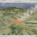
Virtual Terrain Project for Windows 1.1 110804 freeware

The goal of VTP is to foster the creation of tools for easily constructing any part of the real world in interactive, 3D digital form.

This goal will require a synergetic convergence of the fields of CAD, GIS, visual simulation, surveying and remote sensing. VTP gathers information and tracks progress in areas such as procedural scene construction, feature extraction, and rendering algorithms. ...

Author Ben Discoe
Released 2011-09-08
Filesize 1.00 MB
Downloads 455
OS Windows 2000, Windows 2003, Windows XP, Windows Vista
Installation Instal And Uninstall
Keywords libraries, demos, data, open source, VirtualTerrain Project, CAD, GIS, VTP
Users' rating
(15 rating)
Virtual Terrain Project for WindowsCADWindows 2000, Windows 2003, Windows XP, Windows Vista
Virtual Terrain Project for Windows - run as data Freeware Download Notice

Virtual Terrain Project for Windows Free Download - we do not host any Virtual Terrain Project for Windows torrent files or links of Virtual Terrain Project for Windows on rapidshare.com, depositfiles.com, megaupload.com etc. All Virtual Terrain Project for Windows download links are direct Virtual Terrain Project for Windows download from publisher site or their selected mirrors.

Virtual Terrain Project for Windows freeware - The Latest User Reviews
Virtual Terrain Project for Windows freeware - The Latest Versions History
1.1 110804 Sep 8, 2011 New Release Enviro:
Exposed support for more stereo modes: Horizontal and Vertical split.
Options to enable joystick and spacenavigator, rather than just always using them if present.
Smooth continuous update when making buildings.
Option to constrain building point to right angles. Deter user from making bad points.
Made support for Collada (.dae) more explicit in the UI.
Display the version number in the startup dialog.
Added 'every N meters' option to Contour dialog, making it significantly more useful.
Changed 'Move' mode to use Alt modifier key for up/down, to be consistent.
Fixed issues with: support for elevation grids with non-unit vertical scale; removing layers from a terrain; saving snapshot and high-resolution snapshot; buildings with a Geographic CRS; draping of 2D polylines on terrain with vertical exaggeration.

VTBuilder:
Raw layers: Draw polygon holes as dotted lines to tell them from outer edges.

Most popular CAD freeware downloads

PyRx

0.8 freeware download

... potential drug targets. PyRx enables Medicinal Chemists to run Virtual Screening from any platform and helps users in every step of this process - from data preparation to job submission and analysis of the ...

SBSI Visual

1.5.0 freeware download

... as parameter optimisation. To enable registered users to run these algorithms on their models and data, using HPC machines. To provide access for users ...

TNTmips

20240404 freeware download

... you work with virtually any type of geospatial data including imagery, terrain surfaces, and map data with associated database attributes. It provides all the tools you need ...

CiDess

4.28 freeware download

... files - You can include comments and extra data in a PCB file - Automatic web page ... this web site - 100% free - Can run on a 60 MHz Pentium with 16 Mo ...

DWSIM

6.6.2 freeware download

... engineering students and professional chemists, allowing them to run simulations and get a better understanding on a ... it allows them to conduct experiments and analyze data using advanced models and operations, without any cost. ...

SCaVis

2.3 freeware download

SCaVis is an environment for scientific computation, data analysis and data visualization designed for scientists, engineers and students. The ... used everywhere where an analysis of large numerical data volumes, data mining, statistical analysis and mathematics are ...

5 freeware award

EnCalc

4.2 freeware download

... installation program, or just copy the folder and run the program direct. Uninstall by simply deleting the ... Completely portable - No installation needed Can be run from USB Flash drives, etc. Compatible with all ...

ThermoFlo

2.0.9 freeware download

... can be based on empirical, testing, or other data. This approach allows for rapid prototyping and testing ... models (no programming necessary) Steady-state and Transient Analysis Run models in steady-state or transient mode Load Cases ...

NetLogo

6.0.4 freeware download

... can download it free of charge. NetLogo can run simulations for various phenomena, providing 3D modeling tools ... and controlling agents Export and import functions (export data, save and restore state of model, make a ...

TNTmips for Mac OS X

20240111 freeware download

... you work with virtually any type of geospatial data including imagery, terrain surfaces, and map data with associated database attributes. It provides all the tools you need ...