Portable Marble 2.2.0 freeware
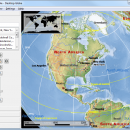
Of course it's also possible to measure distances between locations or watch the current cloud cover. Marble offers different thematic maps: A classroom-style topographic map, a satellite view, street map, earth at night and temperature and precipitation maps. All maps include a custom map key, so it can also be used as an educational tool for use in class-rooms. ...
| Author | Portableapps |
| Released | 2017-05-08 |
| Filesize | 30.10 MB |
| Downloads | 1263 |
| OS | Windows 7, Windows 7 x64, Windows 8, Windows 8 x64, Windows 10, Windows 10 x64 |
| Installation | Instal And Uninstall |
| Keywords | explore Earth, geographical atlas, virtual desktop globe, explore, view, viewer |
| Users' rating (11 rating) |
Portable Marble Free Download - we do not host any Portable Marble torrent files or links of Portable Marble on rapidshare.com, depositfiles.com, megaupload.com etc. All Portable Marble download links are direct Portable Marble download from publisher site or their selected mirrors.
| 2.2.0 | May 10, 2017 | New Release | |
| 1.11.3 | Jul 20, 2015 | New Release | Finding patterns in prominent stars within apparent proximity on Earth's night sky is a human tradition dating back as far as the Neolithic Age. Marble now renders popular stars constellations. |
| 1.9.1 | Aug 26, 2014 | New Release | Finding patterns in prominent stars within apparent proximity on Earth's night sky is a human tradition dating back as far as the Neolithic Age. Marble now renders popular stars constellations. |

