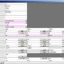
Prode Valves 1.08 freeware

Prode Valves can assist in design, rating and selection of control, safety, relief valves, in addition to procedures for rigorous design and rating Prode Valves offers the benefit to automatically identify the most suitable product and fills in all detailing specifications. ...

Author Prode
Released 2012-06-09
Filesize 5.00 MB
Downloads 410
OS Windows XP, Windows Vista, Windows Vista x64, Windows 7, Windows 7 x64
Installation Instal And Uninstall
Keywords design valve, create safety valve, valve quotation, design, create, valve
Users' rating
(10 rating)
Prode ValvesCADWindows XP, Windows Vista, Windows Vista x64, Windows 7, Windows 7 x64
Prode Valves - remote process Freeware Download Notice

Prode Valves Free Download - we do not host any Prode Valves torrent files or links of Prode Valves on rapidshare.com, depositfiles.com, megaupload.com etc. All Prode Valves download links are direct Prode Valves download from publisher site or their selected mirrors.

Prode Valves freeware - The Latest User Reviews
Prode Valves freeware - The Latest Versions History
1.08 Jun 9, 2012 New Release

Most popular CAD freeware downloads

Panoply for Mac

5.4.3 freeware download

... Panoply is designed to help you view and process the data included in netCDF, HDF, GRIB, and ... as a collection of invididual frame images. Explore remote THREDDS and OpenDAP catalogs and open datasets served ...

JMARS

3.1.5 freeware download

... that stands for Java Mission-planning and Analysis for Remote Sensing. It is a geospatial information system (GIS) ... orbiter data, and has basic image and vector processing features to conveniently compare, plot, and blend data. ...

5 freeware award

Prode Valves

1.08 freeware download

... Powerful search engine to extract from local or remote archives the data which meet the criteria defined ... possible to define a layout to show only process calc's, one for process calc's plus mechanical specifications, ...

JMARS for Windows

3.1.5 freeware download

... that stands for Java Mission-planning and Analysis for Remote Sensing. It is a geospatial information system (GIS) ... orbiter data, and has basic image and vector processing features to conveniently compare, plot, and blend data. ...