SCaVis 2.3 freeware

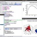
SCaVis is an interactive environment for scientific computation, data analysis and data visualization designed for scientists, engineers and students. The program incorporates many open-source math software packages into a coherent interface using the concept of scripting, rather than only-GUI or macro-based concept. ...

Author Dr. Sergei Chekanov
Released 2015-03-18
Filesize 92.40 MB
Downloads 947
OS Windows XP, Windows Vista, Windows Vista x64, Windows 7, Windows 7 x64, Windows 8, Windows 8 x64
Installation Instal And Uninstall
Keywords data-analysis framework, data manipulation, data plotting, analyze, analysis, analyzer
Users' rating
(32 rating)
SCaVisCADWindows XP, Windows Vista, Windows Vista x64, Windows 7, Windows 7 x64, Windows 8, Windows 8 x64
Our rating 5 freeware award
SCaVis - raster Freeware Download Notice

SCaVis Free Download - we do not host any SCaVis torrent files or links of SCaVis on rapidshare.com, depositfiles.com, megaupload.com etc. All SCaVis download links are direct SCaVis download from publisher site or their selected mirrors.

SCaVis freeware - The Latest User Reviews
SCaVis freeware - The Latest Versions History
2.3 Mar 18, 2015 New Release Bug in showing data in VHTable.
HTable was redone using the native java API
Vector graphics library was updated
Single-jar files were corrected
2.2 Jan 7, 2015 New Release A new canvas HPlotXY for interactive data drawings
Support for jplot2d package, including SVG and SVGZ file outputs
Added 40 Java and Jython examples
A bug in ScaVis IDE that prevent Java code for running was fixed
2.1 Nov 12, 2014 New Release Support for n-dimensional arrays like Numpy. The coding is based on ND4J and JBLAS. All matrix packages were moved to lib/math
Images can be exported to SVGZ (compressed vector graphics). Example: c.export("test.svgz")
Vector graphics output was redesigned. Now EPS, PS and PDF files have better quality since converted from SVG on the fly
Tools to convert between different image formats (for activated version)

Most popular CAD freeware downloads

Panoply for Mac

5.4.3 freeware download

Panoply for Mac is a cross-platform application which plots geo-gridded arrays from netCDF, HDF and GRIB datasets. Panoply is designed to help you view and process ...

QGIS

3.36.1 freeware download

... Open Source Software (FOSS). QGIS supports vector, raster, and database formats and lets you browse and ... data viewing needs. QGIS supports a number of raster and vector data formats, with new support easily ...

TNTmips

20240404 freeware download

... Import and export an unsurpassed number of raster, geometric, and database file formats; convert between data ... Contouring, and Triangulation operations produce Digital Elevation Model rasters (DEMs), contour lines, and triangulated irregular networks (TINs), ...

QGIS for Mac

3.36.1 freeware download

... Open Source Software (FOSS). QGIS supports vector, raster, and database formats and lets you browse and ... data viewing needs. QGIS supports a number of raster and vector data formats, with new support easily ...

QGIS for Linux

3.36.1 freeware download

... Open Source Software (FOSS). QGIS supports vector, raster, and database formats and lets you browse and ... data viewing needs. QGIS supports a number of raster and vector data formats, with new support easily ...

ShareCAD

2.0 freeware download

... STEP, STP, IGES, IGS, BREP, STL, SAT (ACIS); Raster formats: PNG, BMP, JPG, GIF, TIFF, TGA, CAL; Archives: 7z, RAR, CAB, ZIP, BZIP, TAR. ShareCAD ...

Thuban for Windows

1.2.2 freeware download

... Data Support: Shapefile, PostGIS Layer and OGR # Raster Data Support: GeoTIFF Layer and GDAL # Comfortable Map Navigation # Object Identification and Annotation # ...

Thuban for Mac OS X

1.0.1-3 freeware download

... Data Support: Shapefile, PostGIS Layer and OGR # Raster Data Support: GeoTIFF Layer and GDAL # Comfortable Map Navigation # Object Identification and Annotation # ...

Thuban for Linux

1.2.2 freeware download

... Data Support: Shapefile, PostGIS Layer and OGR # Raster Data Support: GeoTIFF Layer and GDAL # Comfortable Map Navigation # Object Identification and Annotation # ...

wxGIS

0.2.0 freeware download

... a tool for correcting the orthographic data from raster TIFF files. ...