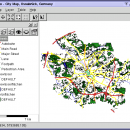
Thuban for Windows 1.2.2 freeware

... Support: Shapefile, PostGIS Layer and OGR
# Raster Data Support: GeoTIFF Layer and GDAL
# Comfortable Map Navigation
# Object Identification and Annotation
# Legend Editor and Classification
# Table Queries and Joins
# Projection Support
# Printing and Vector Export
# API for Add-Ons (Extensions) ...

Author Thuban Development Team
Released 2009-08-18
Filesize 11.22 MB
Downloads 453
OS Windows 2000, Windows 2003, Windows XP, Windows Vista
Installation Instal And Uninstall
Keywords geographic data viewer, gis viewer, analyze geographic information, information, geographic, viewer
Users' rating
(13 rating)
Thuban for WindowsCADWindows 2000, Windows 2003, Windows XP, Windows Vista
Thuban for Windows - raster map Freeware Download Notice

Thuban for Windows Free Download - we do not host any Thuban for Windows torrent files or links of Thuban for Windows on rapidshare.com, depositfiles.com, megaupload.com etc. All Thuban for Windows download links are direct Thuban for Windows download from publisher site or their selected mirrors.

Thuban for Windows freeware - The Latest User Reviews
Thuban for Windows freeware - The Latest Versions History
1.2.2 Aug 18, 2009 New Release

Most popular CAD freeware downloads

Panoply for Mac

5.4.3 freeware download

... one plot by differencing, summing or averaging. Create map plots of trajectory data based on the CF ... Plot lon-lat data on a global or regional map using any of over 200 map projections or ...

QGIS for Linux

3.36.1 freeware download

... Open Source Software (FOSS). QGIS supports vector, raster, and database formats and lets you browse and create map data on your computer. QGIS supports many ...

Thuban for Windows

1.2.2 freeware download

... Data Support: Shapefile, PostGIS Layer and OGR # Raster Data Support: GeoTIFF Layer and GDAL # Comfortable Map Navigation # Object Identification and Annotation # Legend ...

TNTmips

20240404 freeware download

... of geospatial data including imagery, terrain surfaces, and map data with associated database attributes. It provides all ... published on the Internet as web tilesets, Web Map Service (WMS), and ArcIMS ... Automatically generate ...

QGIS

3.36.1 freeware download

... Open Source Software (FOSS). QGIS supports vector, raster, and database formats and lets you browse and create map data on your computer. QGIS supports many ...

Elshayal Smart

23.02 freeware download

... & save GPS route and View and Rectify Raster Images gif, jpg, bmp and Edit shape files, ... query builder, build network, find shortest path, print map, save map image, copy map image to clipboard, ...

QGIS for Mac

3.36.1 freeware download

... Open Source Software (FOSS). QGIS supports vector, raster, and database formats and lets you browse and create map data on your computer. QGIS supports many ...

TNTmips for Mac OS X

20240111 freeware download

... of geospatial data including imagery, terrain surfaces, and map data with associated database attributes. It provides all ... published on the Internet as web tilesets, Web Map Service (WMS), and ArcIMS. Automatically generate hundreds ...

Thuban for Linux

1.2.2 freeware download

... Data Support: Shapefile, PostGIS Layer and OGR # Raster Data Support: GeoTIFF Layer and GDAL # Comfortable Map Navigation # Object Identification and Annotation # Legend ...

Thuban for Mac OS X

1.0.1-3 freeware download

... Data Support: Shapefile, PostGIS Layer and OGR # Raster Data Support: GeoTIFF Layer and GDAL # Comfortable Map Navigation # Object Identification and Annotation # Legend ...