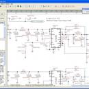
TinyCAD 3.00.04 freeware

... print your designs, you can use TinyCAD to publish your drawings by copying and pasting into a Word document or saving as a PNG bitmap for the web. ...

Author Tinycad.sourceforge.net
Released 2021-10-03
Filesize 16.40 MB
Downloads 6143
OS Windows 2000, Windows 2003, Windows XP, Windows Vista, Windows Vista x64, Windows 7, Windows 7 x64, Windows 8, Windows 8 x64, Windows 10, Windows 10 x64, Windows 10, Windows 10 x64
Installation Instal And Uninstall
Keywords JPEG, PNG, BMP or EMF, geometry editor, Constructive, Geometry, Tiny CAD
Users' rating
(67 rating)
TinyCADCADWindows 2000, Windows 2003, Windows XP, Windows Vista, Windows Vista x64, Windows 7, Windows 7 x64, Windows 8, Windows 8 x64, Windows 10, Windows 10 x64, Windows 10, Windows 10 x64
TinyCAD - publish Freeware Download Notice

TinyCAD Free Download - we do not host any TinyCAD torrent files or links of TinyCAD on rapidshare.com, depositfiles.com, megaupload.com etc. All TinyCAD download links are direct TinyCAD download from publisher site or their selected mirrors.

TinyCAD freeware - The Latest User Reviews

TinyCAD 2.60.01
JBD

(Oct 13, 2010)

Very nice, very light. Salute to the writers.
The significant lack : no option / features for HOT KEY.

TinyCAD 2.60.01
iby

(Aug 16, 2010)

TinyCAD is nice, very smal and powerful schematic capture program that can export netlist in variety of formats, so you can use external PCB design software. It can also export to spice but since it comes with no library for that, you have to make one yourself.
If you don't have PCB software, II would also recommend checking KiCAD which is one stop PCB design solution.

iby

View all TinyCAD reviews

TinyCAD freeware - The Latest Versions History
3.00.04 Oct 3, 2021 New Release
3.00.03 Mar 17, 2021 New Release
3.00.02 Mar 30, 2020 New Release New Feature #3043277 - Show '*' in title bar when document has been changed.
New Feature #3062572 - Auto DRC before netlist generation.
New Feature #3001869 - Add DRC check for unplaced multiple gates This DRC check is active when the "Unconnected nets" option is selected. In the ERC list it is reported as: "Not all parts in this package are in this design".
New Feature #3121004 - Single key Rotate and Duplicate - When a symbol or group of objects is selected, it is now possible to Rotate, Flip and Duplicate with a single keystroke. The recognized keys are: R, L, F and U for Right,Left,Flip and Duplicate respectively.

Most popular CAD freeware downloads

CiDess

4.28 freeware download

... PCB file - Automatic web page generation to publish your PCB - Support both French and English language, ability to change language during program execution ...

TinyCAD

3.00.04 freeware download

... print your designs, you can use TinyCAD to publish your drawings by copying and pasting into a Word document or saving as a PNG bitmap ...

sPlan Viewer

7.0 freeware download

... 5.0 and 4.0. if you want to publish your original schematics e.g. in the Internet, you may offer the free viewer software for downloading. ...

TNTatlas

2024 B20240606 freeware download

... a powerful free geodata viewer that lets you publish and distribute your maps and geospatial data — ... atlas-like manner. With TNTatlas, you become an electronic publisher for your company, your profession, or the general ...

TNTmips

20240404 freeware download

... need to view, create, edit, georeference, interpret, and publish any type of geospatial data. TNTmips provides professional ... Maps imagery and maps or on geodata layers published on the Internet as web tilesets, Web Map ...

TNTatlas for Mac OS X

2024 B20240508 freeware download

... a powerful free geodata viewer that lets you publish and distribute your maps and geospatial data — ... atlas-like manner. With TNTatlas, you become an electronic publisher for your company, your profession, or the general ...

TNTmips for Mac OS X

20240111 freeware download

... need to view, create, edit, georeference, interpret, and publish any type of geospatial data. TNTmips provides professional ... Maps imagery and maps or on geodata layers published on the Internet as web tilesets, Web Map ...