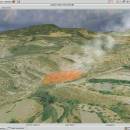
Virtual Terrain Project for Mac OS X and Linux 1.1 110804 freeware

The goal of VTP is to foster the creation of tools for easily constructing any part of the real world in interactive, 3D digital form.

This goal will require a synergetic convergence of the fields of CAD, GIS, visual simulation, surveying and remote sensing. VTP gathers information and tracks progress in areas such as procedural scene construction, feature extraction, and rendering algorithms. ...

Author Ben Discoe
Released 2011-09-08
Filesize 2.20 MB
Downloads 380
OS Linux, Mac OS X
Installation Instal And Uninstall
Keywords libraries, demos, data, open source, VirtualTerrain Project, CAD, GIS, VTP
Users' rating
(11 rating)
Virtual Terrain Project for Mac OS X and LinuxCADLinux, Mac OS X
Virtual Terrain Project for Mac OS X and Linux - project Freeware Download Notice

Virtual Terrain Project for Mac OS X and Linux Free Download - we do not host any Virtual Terrain Project for Mac OS X and Linux torrent files or links of Virtual Terrain Project for Mac OS X and Linux on rapidshare.com, depositfiles.com, megaupload.com etc. All Virtual Terrain Project for Mac OS X and Linux download links are direct Virtual Terrain Project for Mac OS X and Linux download from publisher site or their selected mirrors.

Virtual Terrain Project for Mac OS X and Linux freeware - The Latest User Reviews
Virtual Terrain Project for Mac OS X and Linux freeware - The Latest Versions History
1.1 110804 Sep 8, 2011 New Release Enviro:
Exposed support for more stereo modes: Horizontal and Vertical split.
Options to enable joystick and spacenavigator, rather than just always using them if present.
Smooth continuous update when making buildings.
Option to constrain building point to right angles. Deter user from making bad points.
Made support for Collada (.dae) more explicit in the UI.
Display the version number in the startup dialog.
Added 'every N meters' option to Contour dialog, making it significantly more useful.
Changed 'Move' mode to use Alt modifier key for up/down, to be consistent.
Fixed issues with: support for elevation grids with non-unit vertical scale; removing layers from a terrain; saving snapshot and high-resolution snapshot; buildings with a Geographic CRS; draping of 2D polylines on terrain with vertical exaggeration.

VTBuilder:
Raw layers: Draw polygon holes as dotted lines to tell them from outer edges.

Most popular CAD freeware downloads

Panoply for Mac

5.4.3 freeware download

... utility can also combine two arrays and can project the analysis using more than 100 maps. What’s ... regional map using any of over 200 map projections or make a zonal average line plot. Overlay ...

Woodland Potential Calculator

2.01 freeware download

... opportunities and constraints to woodland creation. Subsequently, this project was considerably extended and adopted as a national system. It is currently being used to compile ...

Freeship Plus

3.43+ freeware download

... the indication of parameters, published allowable ranges. If projected the vessel does not correspond to any serial ... regular changes of parameters of a vessel, to project marine and river boats, catamarans, trawlers, high-speed motorboats, ...

SCIRun

4.7 freeware download

... Acknowledgement: SCIRun is an Open Source software project that is principally funded through the SCI Institute's NIH/NCRR CIBC Center. Please use the following acknowledgment ...

Qucs

0.0.19 freeware download

... has been programmed for usage in the Qucs project but may also be used by other applications. ... well developed, we still strive to improve the project, and will always welcome offers of help. Qucs ...

OpenBabelGUI

2.4.1 freeware download

... languages of chemical data. It's an open, collaborative project allowing anyone to search, convert, analyze, or store data from molecular modeling, chemistry, biochemistry, or related ...

nanoCAD

5.1.2524.2017 freeware download

... nanoCAD has been built to deliver design and project documentation regardless of the industry or enterprise. And ... *.dwg - is the nanoCAD native file format. Projects created using nanoCAD and saved as *.dwg file ...

RADlab

1.03 freeware download

... is modeled as pure lead collimator. Project Aim: An extendible, flexible and easy to use virtual environment is created for Radiation Detection ...

Thuban for Windows

1.2.2 freeware download

... and Classification # Table Queries and Joins # Projection Support # Printing and Vector Export # API ... is Thuban being developed? [2001:] The FreeGIS Project provides an overview of Free Software GIS projects. ...

UnLocBoX

1.5.0 freeware download

... toolbox. UnLocBoX is part of the UnlocX project and contains the most used algorithms (Douglas-Rachford, forward backward, ppxa). Furthermore, a set of proximal operators ...