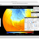
Panoply for Mac 5.4.3 freeware

Panoply for Mac is an utility that enable user to plot raster image. Depending on the data, it can draw global longitude-latitude images or pole-to-pole latitude-vertical images.Panoply is a cross-platform application which plots geo-gridded arrays from netCDF, HDF and GRIB datasets. The utility can also combine two arrays and can project the analysis using more than 100 maps. ...

Author Robert B. Schmunk
Released 2024-06-24
Filesize 36.40 MB
Downloads 859
OS Mac OS X
Installation Instal And Uninstall
Keywords plot raster image, longitude image, pole-to-pole image, raster image, rasterize, raster
Users' rating
(36 rating)
Panoply for MacCADMac OS X
Panoply for Mac - png Freeware Download Notice

Panoply for Mac Free Download - we do not host any Panoply for Mac torrent files or links of Panoply for Mac on rapidshare.com, depositfiles.com, megaupload.com etc. All Panoply for Mac download links are direct Panoply for Mac download from publisher site or their selected mirrors.

Panoply for Mac freeware - The Latest User Reviews
Panoply for Mac freeware - The Latest Versions History
5.4.3 Jun 24, 2024 New Release
5.4.1 Jun 1, 2024 New Release
5.4.0 May 11, 2024 New Release

Most popular CAD freeware downloads

Panoply for Mac

5.4.3 freeware download

... color table. Save plots to disk GIF, JPEG, PNG or TIFF bitmap images or as PDF or PostScript graphics files. Export lon-lat map plots in ...

TinyCAD

3.00.04 freeware download

... into a Word document or saving as a PNG bitmap for the web. You can use ... documents. Turn your circuit diagrams in to PNG images Although you might want to put ...

ShareCAD

2.0 freeware download

... IGES, IGS, BREP, STL, SAT (ACIS); Raster formats: PNG, BMP, JPG, GIF, TIFF, TGA, CAL; Archives: 7z, RAR, CAB, ZIP, BZIP, TAR. ShareCAD enables you ...

Online CAD Converter

1.5 freeware download

Online CAD Converter is the safest solution to convert CAD, CGM, HPGL, SVG files. Output file types include PDF, TIFF, JPEG, EMF, CGM, HPGL, and SVG. ...

Mobile Atlas Creator

2.2.1 freeware download

... individual maps can be exported as one large PNG image with calibration MAP file for OziExplorer. As ... (Android) OSMtracker (Windows Mobile/Pocket PC) OziExplorer (single 24bit PNG image with calibration (MAP) file PathAway (Windows Mobile) ...

Mobile Atlas Creator for Mac OS X

2.2.1 freeware download

... individual maps can be exported as one large PNG image with calibration MAP file for OziExplorer. As ... (Android) OSMtracker (Windows Mobile/Pocket PC) OziExplorer (single 24bit PNG image with calibration (MAP) file PathAway (Windows Mobile) ...

Euler Math Toolbox

2024-01-14 freeware download

... save the graphics in various formats, among them PNG and SVG. Graphics can also be imported into the text window, exported to files or to ...

Gnuplot for Windows

5.2.7 freeware download

... direct output to file: postscript (including eps), pdf, png, gif, jpeg, LaTeX, metafont, emf, svg, ... mouseable web display formats: HTML5, svg Features: ...

Fun3D

1.0.4.15 Beta freeware download

... visualization tool. Features: 2D Export (JPG, PNG) 3D Export (JavaView - jvx, DXF, 3DM) Video Export (AVI) Animation 3D Surfaces 3D Curves 3D ...

Fun3D Portable

1.0.4.15 Beta freeware download

... visualization tool. Features: 2D Export (JPG, PNG) 3D Export (JavaView - jvx, DXF, 3DM) Video Export (AVI) Animation 3D Surfaces 3D Curves 3D ...