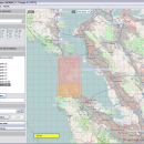
Mobile Atlas Creator 2.2.1 freeware

Mobile Atlas Creator is a small, simple, Java based application specially designed to help you create atlases for TrekBuddy. Basically this software will create offline atlases for GPS handhelds and cell phone applications like TrekBuddy, AndNav and other Android and WindowsCE based applications. ...

Author Fredrik Moller
Released 2021-06-02
Filesize 15.00 MB
Downloads 2242
OS Windows XP, Windows Vista, Windows Vista x64, Windows 7, Windows 7 x64, Windows 8, Windows 8 x64, Windows 10, Windows 10 x64, Linux
Installation Instal And Uninstall
Keywords create atlas, generate atlas, atlas creator, generator, generate, create
Users' rating
(24 rating)
Mobile Atlas CreatorCADWindows XP, Windows Vista, Windows Vista x64, Windows 7, Windows 7 x64, Windows 8, Windows 8 x64, Windows 10, Windows 10 x64, Linux
Mobile Atlas Creator - png Freeware Download Notice

Mobile Atlas Creator Free Download - we do not host any Mobile Atlas Creator torrent files or links of Mobile Atlas Creator on rapidshare.com, depositfiles.com, megaupload.com etc. All Mobile Atlas Creator download links are direct Mobile Atlas Creator download from publisher site or their selected mirrors.

Mobile Atlas Creator freeware - The Latest User Reviews
Mobile Atlas Creator freeware - The Latest Versions History
2.2.1 Jun 2, 2021 New Release
2.1.3 Rev 24 Apr 14, 2020 New Release Minimum supported Java version increased to Java 8 (1.8)
"mapFile must not be null" error when creating an atlas
Save settings to settings.xml in UTF-8 format (fix for #324)
Map creation error with JPEG (Garmin Custom and others) (fix for #326)
2.1.2 Rev 24 Oct 11, 2019 New Release Minimum supported Java version increased to Java 8 (1.8)
"mapFile must not be null" error when creating an atlas
Save settings to settings.xml in UTF-8 format (fix for #324)
Map creation error with JPEG (Garmin Custom and others) (fix for #326)

Most popular CAD freeware downloads

Panoply for Mac

5.4.3 freeware download

... color table. Save plots to disk GIF, JPEG, PNG or TIFF bitmap images or as PDF or PostScript graphics files. Export lon-lat map plots in ...

SCaVis

2.3 freeware download

... plots can be exported to raster formats (PDF, PNG, JPG, etc.) and high-quality vector formats (PostScript, EPS) ready to be included into presentations and scientific ...

5 freeware award

Digimizer

6.4.0 freeware download

... Supported file formats are JPG, GIF, TIFF, BMP, PNG, WMF, EMF and DICOM files. Images can ... (native Digimizer file format), JPG, GIF, TIFF, BMP, PNG, WMF, EMF, and DICOM files. Image manipulation ...

Euler Math Toolbox

2024-01-14 freeware download

... save the graphics in various formats, among them PNG and SVG. Graphics can also be imported into the text window, exported to files or to ...

Circuit Diagram

3.1.0 B3 freeware download

... your electrical circuit and then export it as: PNG - best compatibility SVG - no loss of quality when scaling Currently supported components: Logic ...

VEGA ZZ

3.2.3.28 freeware download

... formats are: BMP, GIF 256 colors, JPEG, PCX, PNG, PNM, RAW, SGI, TGA and TIFF. Vector graphic rendering engine. It's possible to export the ...

TNTatlas

2024 B20240606 freeware download

... display numerous file formats including shapefiles, GeoTIFF, JP2, PNG, MrSID, DXF, and DWG. Geospatial information plays a growing part in the way we work ...

TNTmips

20240404 freeware download

... Direct display of popular formats including GeoTIFF, JPEG2000, PNG, MrSID, ECW, shapefile, File Geodatabase, Oracle Spatial, DGN, TAB, DXF, DWG ... Full-featured GIS that ...

TNTatlas for Mac OS X

2024 B20240508 freeware download

... display numerous file formats including shapefiles, GeoTIFF, JP2, PNG, MrSID, DXF, and DWG. Geospatial information plays a growing part in the way we work ...

Online CAD Converter

1.5 freeware download

Online CAD Converter is the safest solution to convert CAD, CGM, HPGL, SVG files. Output file types include PDF, TIFF, JPEG, EMF, CGM, HPGL, and SVG. ...