Panoply for Mac 5.4.3 freeware

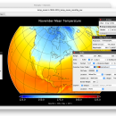
Panoply for Mac is an utility that enable user to plot raster image. Depending on the data, it can draw global longitude-latitude images or pole-to-pole latitude-vertical images.Panoply is a cross-platform application which plots geo-gridded arrays from netCDF, HDF and GRIB datasets. The utility can also combine two arrays and can project the analysis using more than 100 maps. ...

Author Robert B. Schmunk
Released 2024-06-24
Filesize 36.40 MB
Downloads 782
OS Mac OS X
Installation Instal And Uninstall
Keywords plot raster image, longitude image, pole-to-pole image, raster image, rasterize, raster
Users' rating
(29 rating)
Panoply for MacCADMac OS X
Panoply for Mac - overlay Freeware Download Notice

Panoply for Mac Free Download - we do not host any Panoply for Mac torrent files or links of Panoply for Mac on rapidshare.com, depositfiles.com, megaupload.com etc. All Panoply for Mac download links are direct Panoply for Mac download from publisher site or their selected mirrors.

Panoply for Mac freeware - The Latest User Reviews
Panoply for Mac freeware - The Latest Versions History
5.4.3 Jun 24, 2024 New Release
5.4.1 Jun 1, 2024 New Release
5.4.0 May 11, 2024 New Release

Most popular CAD freeware downloads

Panoply for Mac

5.4.3 freeware download

... the scale range, to customize labels, vectors, to overlay masks, and so on. All in all, finding ... than 100 maps. What’s more, you get to overlay continent, or other types of masks on top ...

Digimizer

6.4.0 freeware download

... or pixels Image analysis Binarization Options: overlay binary image, hide binary layer Morphological operations: Dilate, Erode, Open, Close Noise reduction Analyze objects: object ...

TNTmips

20240404 freeware download

... an affordable price without costly add-ons. Precisely overlay geodata layers in a variety of data types ... a wide variety of external formats without importing. Overlay your geodata on Bing Maps imagery and maps ...

TNTmips for Mac OS X

20240111 freeware download

... an affordable price without costly add-ons. Precisely overlay geodata layers in a variety of data types ... a wide variety of external formats without importing. Overlay your geodata on Bing Maps imagery and maps ...

VeeCAD

2.39 Release 1 freeware download

... get full documentation, including a loading diagram, board overlay, parts and wires lists. Engineers and hobbyists use VeeCAD for prototypes and small quantity builds, ...

JMARS

3.1.5 freeware download

... (thermal inertia, mineral composition, digital elevations, etc.) and overlay them into a single, registered multilayer image. * Make topographic profiles, extract surface temperatures (day or ...

5 freeware award

Pro Yacht

1.0.0.1 freeware download

... native text file format can be used to overlay flow lines and pressure data from CFD analysis onto the hull surface. Introducing PolyCAD 9.0: ...

QFitsView

8.6 freeware download

... galaxies or distant quasars. Additionally, DS9 supports the overlay of multiple data sets, allowing for comparative analysis and enhanced data interpretation. DS9 also offers ...

JMARS for Windows

3.1.5 freeware download

... (thermal inertia, mineral composition, digital elevations, etc.) and overlay them into a single, registered multilayer image. * Make topographic profiles, extract surface temperatures (day or ...