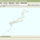
wxGIS Portable 0.4.1 freeware

wxGIS is a useful application that allows you to manage and to organize multiple types of geographic information. The program has an Explorer-like interface that is able to store the geographic coordinate systems in folders. It also includes a vector file export utility and a tool for correcting the orthographic data from raster TIFF files. ...

Author Dmitry Barishnikov
Released 2012-11-15
Filesize 9.70 MB
Downloads 343
OS Windows XP, Windows Vista, Windows Vista x64, Windows 7, Windows 7 x64
Installation Instal And Uninstall
Keywords GIS catalog, manage geography data, geographic coordinate system, manage, catalog, geography
Users' rating
(8 rating)
wxGIS PortableCADWindows XP, Windows Vista, Windows Vista x64, Windows 7, Windows 7 x64
wxGIS Portable - open source Freeware Download Notice

wxGIS Portable Free Download - we do not host any wxGIS Portable torrent files or links of wxGIS Portable on rapidshare.com, depositfiles.com, megaupload.com etc. All wxGIS Portable download links are direct wxGIS Portable download from publisher site or their selected mirrors.

wxGIS Portable freeware - The Latest User Reviews
wxGIS Portable freeware - The Latest Versions History
0.4.1 Nov 15, 2012 New Release · The DEM interpolation switch (bilinear or cubic) in orthocorrect tool
· Russian interface translation
· Rename item support
· Automatic rename output files in batch export
· The ortho-correction tool become more accurate and speedy

Most popular CAD freeware downloads

Woodland Potential Calculator

2.01 freeware download

Woodland Potential Calculator was specially developed as a data collection and presentation instrument. It is designed to calculate the potential for increasing the extent of ...

Gmsh

4.13.1 freeware download

Gmsh is an automatic 3D finite element grid generator (primarily Delaunay) with a build-in CAD engine and post-processor. Its design goal is to provide a simple ...

QGIS for Linux

3.36.1 freeware download

... of and proud to be itself Free and Open Source Software (FOSS). QGIS supports vector, raster, and ...

PreviSat

6.1.0.3 freeware download

PreviSat is a satellite tracking program designed for observing purposes. Very easy to use, it shows the positions of satellites in real-time or manual mode. PreviSat ...

GProX

1.1.16 freeware download

The Graphical Proteomics Data Explorer (GProX) is a freely available complete software platform for comprehensive and integrated analysis and visualization of large proteomics datasets. The program ...

Qucs

0.0.19 freeware download

Qucs is a circuit simulator with graphical user interface. The software aims to support all kinds of circuit simulation types, e.g. DC, AC, S-parameter, Harmonic Balance ...

Jmol

14.31.53 freeware download

Jmol is an applet and Java based application designed to display various 3D chemical information. Jmol's features include reading a variety of file types and ...

KinetDS

3.0 Rev 2010 freeware download

KinetDS is a software for curve fitting particularly designed for kinetic (mechanistic and empirical) description of a substance dissolution from solid state. It was primarily designed ...

SCIRun

4.7 freeware download

... SCIRun is available for free and is open source. Acknowledgement: SCIRun is an Open Source software project that is principally funded through the

Graph Streaming

0.7.0.12 freeware download

The purpose of the Graph Streaming API is to build a unified framework for streaming graph objects. Gephi’s data structure and visualization engine has been built ...