Engauge Digitizer for Windows 12.0 freeware

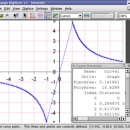
... file showing a graph or map, into numbers. The image file can come from a scanner, digital camera or screenshot. The numbers can be read on the screen, and written or copied to a spreadsheet.

The process starts with an image file containing a graph or map. The final result is digitized data that can be ...

Author Mark Mitchell
Released 2019-08-19
Filesize 10.60 MB
Downloads 922
OS Windows 2000, Windows 2003, Windows XP, Windows Vista, Windows Vista x64
Installation Instal And Uninstall
Keywords digitize image, image to number, process image, digitize, convert, digitizer
Users' rating
(29 rating)
Engauge Digitizer for WindowsCADWindows 2000, Windows 2003, Windows XP, Windows Vista, Windows Vista x64
Our rating 5 freeware award
Engauge Digitizer for Windows - on the fly Freeware Download Notice

Engauge Digitizer for Windows Free Download - we do not host any Engauge Digitizer for Windows torrent files or links of Engauge Digitizer for Windows on rapidshare.com, depositfiles.com, megaupload.com etc. All Engauge Digitizer for Windows download links are direct Engauge Digitizer for Windows download from publisher site or their selected mirrors.

Engauge Digitizer for Windows freeware - The Latest User Reviews
Engauge Digitizer for Windows freeware - The Latest Versions History
12.0 Aug 19, 2019 New Release
10.4 Oct 11, 2017 New Release Show warning message when grid line maximum is exceed (#244)
CSV export files have double quotes on fields with internal commas (#243)
Status bar shows all of text for right-to-left languages (#240)
5.1 Dec 24, 2012 New Release Fix for broken point matching, and control of the x/theta axis label.

Most popular CAD freeware downloads

Engauge Digitizer for Mac OS X

12.0 freeware download

... file showing a graph or map, into numbers. The image file can come from a scanner, digital camera or screenshot. The numbers can be read on the screen, and ...

5 freeware award

QGIS for Linux

3.36.1 freeware download

... to use GIS, providing common functions and features. The initial goal was to provide a GIS data ... data formats, with new support easily added using the plugin architecture. Here are some key features ...

eMachineShop 3D CAD

1.52 freeware download

... to order your custom parts online. Choose from the most popular machining services such as CNC milling, ... plastics are offered. Try it today! Gone are the long waits for quotes. eMachineShop software generates quotations ...

Engauge Digitizer for Linux

12.0 freeware download

... file showing a graph or map, into numbers. The image file can come from a scanner, digital camera or screenshot. The numbers can be read on the screen, and ...

QGIS for Mac

3.36.1 freeware download

... to use GIS, providing common functions and features. The initial goal was to provide a GIS data ... data formats, with new support easily added using the plugin architecture. Here are some key features ...

Ctrax

0.5.19b freeware download

... open-source, freely available, machine vision program for estimating the positions and orientations of many walking flies, maintaining ... is to provide quantitative behavior analysis tools to the neuroethology community, thus we've endeavored to make the ...

JMARS

3.1.5 freeware download

... instrument team members, students of all ages, and the general public. JMARS provides free and efficient ... out to work with data for Earth and the Moon, for which separate versions now exist. In ...

5 freeware award

Engauge Digitizer for Windows

12.0 freeware download

... file showing a graph or map, into numbers. The image file can come from a scanner, digital camera or screenshot. The numbers can be read on the screen, and ...

5 freeware award

JMARS for Windows

3.1.5 freeware download

... instrument team members, students of all ages, and the general public. JMARS provides free and efficient ... out to work with data for Earth and the Moon, for which separate versions now exist. In ...

QGIS

3.36.1 freeware download

... to use GIS, providing common functions and features. The initial goal was to provide a GIS data ... data formats, with new support easily added using the plugin architecture. Here are some key features ...