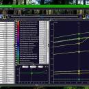
21st century worldwide growth of Forest 8.24 freeware
Ever heard about the Greenhouse effect? - this simulation is looking post the climate discussion. How much fossile resources are there? how much Coal, Gas and Oil are delivered? - if we continue to fire it up, how much CO2 is that? - how much Water is there in Clouds, and how fast will Forest grow if we got more? - This simulation will allow you to check it out, so think self. Grow Earth's Resources over time. All Formulas explained ...
| Author | Dynamic Applications |
| Released | 2024-02-29 |
| Filesize | 8.11 MB |
| Downloads | 1395 |
| OS | Win2000, Windows XP, Windows 7 x32, Windows 7 x64, Windows 8, Windows 10, WinServer, WinOther, Windows 2000, Windows 2003, Windows Server 2000, Windows Server 2003, Windows Server 2008, Windows Server 2008r2, Windows Server 2012, Windows Tablet PC Edition 2005, Windows Media Center Editi |
| Installation | Install and Uninstall |
| Keywords | 21st century, worldwide, growth, Forest, Nature, Clouds, CO2, Climate, Sunshine, Weather, Greenland, Science, Simulation, System Dynamics, dynamicons, Dynamic Applications |
| Users' rating (512 rating) |
21st century worldwide growth of Forest Free Download - we do not host any 21st century worldwide growth of Forest torrent files or links of 21st century worldwide growth of Forest on rapidshare.com, depositfiles.com, megaupload.com etc. All 21st century worldwide growth of Forest download links are direct 21st century worldwide growth of Forest download from publisher site or their selected mirrors.
21st century worldwide growth of Forest 2.50 |
many open ends, but interesting... |
| 8.24 | Feb 29, 2024 | New Release | v8.24 - Broken Weblink for Windows 10 Store corrected. v8.16 - AGB, Terms and Conditions and dna license included as (PDF). v8.16 - art. 14 agb defines property taxation, and the basic right to settle from a shelter. v8.12 - Photovoltaic System (2024) Models with 500 Wp per Panel at 200 Euro. |
| 8.32 | Apr 25, 2024 | New Release | v8.32 - AGB, Terms and Conditions (en/de) available in english and german. v8.24 - Broken Weblink for Windows 10 Store corrected. v8.16 - AGB, Terms and Conditions and dna license included as (PDF). v8.16 - art. 14 agb defines property taxation, and the basic right to settle from a shelter. |
| 8.24 | Feb 29, 2024 | New Release | v8.24 - Broken Weblink for Windows 10 Store corrected. v8.16 - AGB, Terms and Conditions and dna license included as (PDF). v8.16 - art. 14 agb defines property taxation, and the basic right to settle from a shelter. v8.12 - Photovoltaic System (2024) Models with 500 Wp per Panel at 200 Euro. |


